You are here: Home > Network List > TA - USArray Transportable Network (new EarthScope stations) Stations List
> Station R33M Jennings River, BC, CAN > Earthquake Result Viewer
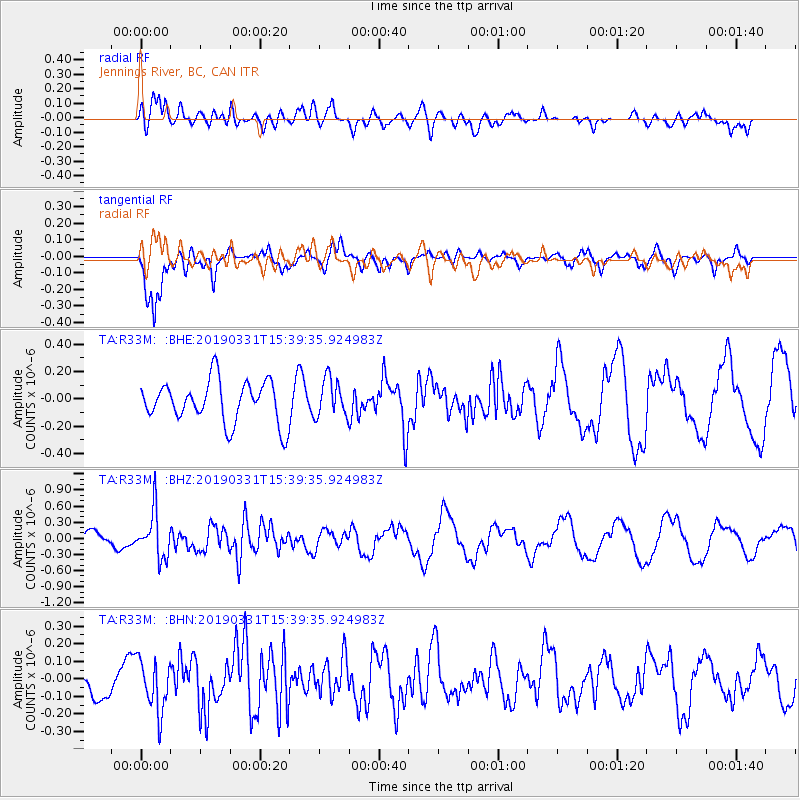
R33M Jennings River, BC, CAN - Earthquake Result Viewer
*The percent match for this event was below the threshold and hence no stack was calculated.
| Earthquake location: |
Off Coast Of Northern Peru |
| Earthquake latitude/longitude: |
-10.0/-79.3 |
| Earthquake time(UTC): |
2019/03/31 (090) 15:27:57 GMT |
| Earthquake Depth: |
29 km |
| Earthquake Magnitude: |
5.5 Mww |
| Earthquake Catalog/Contributor: |
NEIC PDE/us |
|
| Network: |
TA USArray Transportable Network (new EarthScope stations) |
| Station: |
R33M Jennings River, BC, CAN |
| Lat/Lon: |
59.39 N/130.97 W |
| Elevation: |
1437 m |
|
| Distance: |
80.5 deg |
| Az: |
335.996 deg |
| Baz: |
128.442 deg |
| Ray Param: |
$rayparam |
*The percent match for this event was below the threshold and hence was not used in the summary stack. |
|
| Radial Match: |
56.192795 % |
| Radial Bump: |
400 |
| Transverse Match: |
85.927986 % |
| Transverse Bump: |
305 |
| SOD ConfigId: |
13570011 |
| Insert Time: |
2019-05-02 20:44:40.929 +0000 |
| GWidth: |
2.5 |
| Max Bumps: |
400 |
| Tol: |
0.001 |
|
Signal To Noise
| Channel | StoN | STA | LTA |
| TA:R33M: :BHZ:20190331T15:39:35.924983Z | 2.570799 | 4.313765E-7 | 1.677986E-7 |
| TA:R33M: :BHN:20190331T15:39:35.924983Z | 1.1367949 | 1.4692866E-7 | 1.2924816E-7 |
| TA:R33M: :BHE:20190331T15:39:35.924983Z | 0.90893793 | 1.377573E-7 | 1.5155854E-7 |
| Arrivals |
| Ps | |
| PpPs | |
| PsPs/PpSs | |


