You are here: Home > Network List > US - United States National Seismic Network Stations List
> Station ELK Elko, Nevada, USA > Earthquake Result Viewer
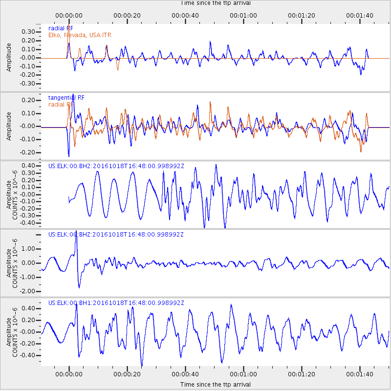
ELK Elko, Nevada, USA - Earthquake Result Viewer
*The percent match for this event was below the threshold and hence no stack was calculated.
| Earthquake location: |
South Of Fiji Islands |
| Earthquake latitude/longitude: |
-23.3/-179.9 |
| Earthquake time(UTC): |
2016/10/18 (292) 16:36:41 GMT |
| Earthquake Depth: |
540 km |
| Earthquake Magnitude: |
5.9 MWW, 6.0 MWB |
| Earthquake Catalog/Contributor: |
NEIC PDE/NEIC COMCAT |
|
| Network: |
US United States National Seismic Network |
| Station: |
ELK Elko, Nevada, USA |
| Lat/Lon: |
40.74 N/115.24 W |
| Elevation: |
2210 m |
|
| Distance: |
87.5 deg |
| Az: |
43.426 deg |
| Baz: |
236.276 deg |
| Ray Param: |
$rayparam |
*The percent match for this event was below the threshold and hence was not used in the summary stack. |
|
| Radial Match: |
74.03126 % |
| Radial Bump: |
335 |
| Transverse Match: |
71.12508 % |
| Transverse Bump: |
400 |
| SOD ConfigId: |
1815711 |
| Insert Time: |
2016-11-01 16:39:22.854 +0000 |
| GWidth: |
2.5 |
| Max Bumps: |
400 |
| Tol: |
0.001 |
|
Signal To Noise
| Channel | StoN | STA | LTA |
| US:ELK:00:BHZ:20161018T16:48:00.998992Z | 5.3763404 | 1.0020284E-6 | 1.8637742E-7 |
| US:ELK:00:BH1:20161018T16:48:00.998992Z | 1.1169927 | 2.3625685E-7 | 2.1151155E-7 |
| US:ELK:00:BH2:20161018T16:48:00.998992Z | 0.8077731 | 1.5645726E-7 | 1.936896E-7 |
| Arrivals |
| Ps | |
| PpPs | |
| PsPs/PpSs | |


