You are here: Home > Network List > WY - Yellowstone Wyoming Seismic Network Stations List
> Station YHH Holmes Hill, YNP, WY, USA > Earthquake Result Viewer
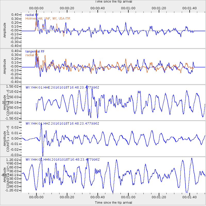
YHH Holmes Hill, YNP, WY, USA - Earthquake Result Viewer
*The percent match for this event was below the threshold and hence no stack was calculated.
| Earthquake location: |
South Of Fiji Islands |
| Earthquake latitude/longitude: |
-23.3/-179.9 |
| Earthquake time(UTC): |
2016/10/18 (292) 16:36:41 GMT |
| Earthquake Depth: |
540 km |
| Earthquake Magnitude: |
5.9 MWW, 6.0 MWB |
| Earthquake Catalog/Contributor: |
NEIC PDE/NEIC COMCAT |
|
| Network: |
WY Yellowstone Wyoming Seismic Network |
| Station: |
YHH Holmes Hill, YNP, WY, USA |
| Lat/Lon: |
44.79 N/110.85 W |
| Elevation: |
2717 m |
|
| Distance: |
92.4 deg |
| Az: |
41.734 deg |
| Baz: |
239.247 deg |
| Ray Param: |
$rayparam |
*The percent match for this event was below the threshold and hence was not used in the summary stack. |
|
| Radial Match: |
56.508327 % |
| Radial Bump: |
400 |
| Transverse Match: |
53.81804 % |
| Transverse Bump: |
400 |
| SOD ConfigId: |
1815711 |
| Insert Time: |
2016-11-01 16:40:40.332 +0000 |
| GWidth: |
2.5 |
| Max Bumps: |
400 |
| Tol: |
0.001 |
|
Signal To Noise
| Channel | StoN | STA | LTA |
| WY:YHH:01:HHZ:20161018T16:48:23.477996Z | 2.8223739 | 1.3609503E-8 | 4.8220055E-9 |
| WY:YHH:01:HHN:20161018T16:48:23.477996Z | 2.2318666 | 8.88677E-9 | 3.981766E-9 |
| WY:YHH:01:HHE:20161018T16:48:23.477996Z | 1.9236761 | 7.920438E-9 | 4.1173447E-9 |
| Arrivals |
| Ps | |
| PpPs | |
| PsPs/PpSs | |


