You are here: Home > Network List > WY - Yellowstone Wyoming Seismic Network Stations List
> Station YUF Upper Falls, WY, USA > Earthquake Result Viewer
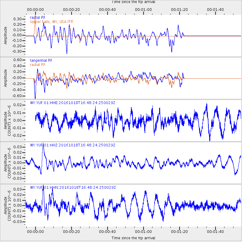
YUF Upper Falls, WY, USA - Earthquake Result Viewer
*The percent match for this event was below the threshold and hence no stack was calculated.
| Earthquake location: |
South Of Fiji Islands |
| Earthquake latitude/longitude: |
-23.3/-179.9 |
| Earthquake time(UTC): |
2016/10/18 (292) 16:36:41 GMT |
| Earthquake Depth: |
540 km |
| Earthquake Magnitude: |
5.9 MWW, 6.0 MWB |
| Earthquake Catalog/Contributor: |
NEIC PDE/NEIC COMCAT |
|
| Network: |
WY Yellowstone Wyoming Seismic Network |
| Station: |
YUF Upper Falls, WY, USA |
| Lat/Lon: |
44.71 N/110.51 W |
| Elevation: |
2394 m |
|
| Distance: |
92.6 deg |
| Az: |
41.923 deg |
| Baz: |
239.476 deg |
| Ray Param: |
$rayparam |
*The percent match for this event was below the threshold and hence was not used in the summary stack. |
|
| Radial Match: |
52.88903 % |
| Radial Bump: |
400 |
| Transverse Match: |
41.446705 % |
| Transverse Bump: |
353 |
| SOD ConfigId: |
1815711 |
| Insert Time: |
2016-11-01 16:40:53.044 +0000 |
| GWidth: |
2.5 |
| Max Bumps: |
400 |
| Tol: |
0.001 |
|
Signal To Noise
| Channel | StoN | STA | LTA |
| WY:YUF:01:HHZ:20161018T16:48:24.250029Z | 2.4735534 | 1.5042314E-8 | 6.081257E-9 |
| WY:YUF:01:HHN:20161018T16:48:24.250029Z | 1.5314025 | 1.34321265E-8 | 8.771128E-9 |
| WY:YUF:01:HHE:20161018T16:48:24.250029Z | 1.0488324 | 6.582276E-9 | 6.2758128E-9 |
| Arrivals |
| Ps | |
| PpPs | |
| PsPs/PpSs | |


