You are here: Home > Network List > GS - US Geological Survey Networks Stations List
> Station KAN10 Keim Farm > Earthquake Result Viewer
KAN10 Keim Farm - Earthquake Result Viewer
*The percent match for this event was below the threshold and hence no stack was calculated.
| Earthquake location: |
Leeward Islands |
| Earthquake latitude/longitude: |
15.2/-61.5 |
| Earthquake time(UTC): |
2016/10/18 (292) 22:08:14 GMT |
| Earthquake Depth: |
143 km |
| Earthquake Magnitude: |
5.6 MWW, 5.6 MWB |
| Earthquake Catalog/Contributor: |
NEIC PDE/NEIC COMCAT |
|
| Network: |
GS US Geological Survey Networks |
| Station: |
KAN10 Keim Farm |
| Lat/Lon: |
37.12 N/98.10 W |
| Elevation: |
417 m |
|
| Distance: |
39.1 deg |
| Az: |
310.901 deg |
| Baz: |
114.094 deg |
| Ray Param: |
$rayparam |
*The percent match for this event was below the threshold and hence was not used in the summary stack. |
|
| Radial Match: |
29.474346 % |
| Radial Bump: |
400 |
| Transverse Match: |
33.44816 % |
| Transverse Bump: |
400 |
| SOD ConfigId: |
1815711 |
| Insert Time: |
2016-11-01 22:10:26.224 +0000 |
| GWidth: |
2.5 |
| Max Bumps: |
400 |
| Tol: |
0.001 |
|
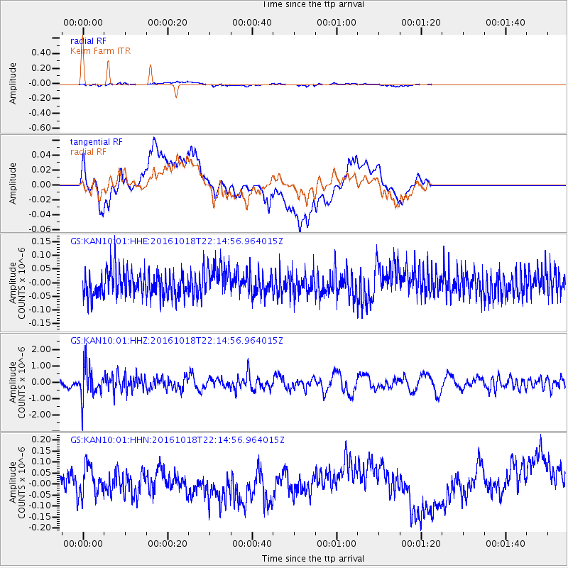
Signal To Noise
| Channel | StoN | STA | LTA |
| GS:KAN10:01:HHZ:20161018T22:14:56.964015Z | 4.0762687 | 9.634243E-7 | 2.3634956E-7 |
| GS:KAN10:01:HHN:20161018T22:14:56.964015Z | 1.1788132 | 6.459673E-8 | 5.4798107E-8 |
| GS:KAN10:01:HHE:20161018T22:14:56.964015Z | 1.2962409 | 5.7441554E-8 | 4.4313946E-8 |
| Arrivals |
| Ps | |
| PpPs | |
| PsPs/PpSs | |


