You are here: Home > Network List > GS - US Geological Survey Networks Stations List
> Station OK031 2598 S. Brethren Rd., Cushing, OK, USA > Earthquake Result Viewer
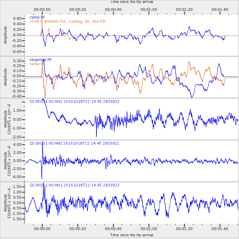
OK031 2598 S. Brethren Rd., Cushing, OK, USA - Earthquake Result Viewer
*The percent match for this event was below the threshold and hence no stack was calculated.
| Earthquake location: |
Leeward Islands |
| Earthquake latitude/longitude: |
15.2/-61.5 |
| Earthquake time(UTC): |
2016/10/18 (292) 22:08:14 GMT |
| Earthquake Depth: |
143 km |
| Earthquake Magnitude: |
5.6 MWW, 5.6 MWB |
| Earthquake Catalog/Contributor: |
NEIC PDE/NEIC COMCAT |
|
| Network: |
GS US Geological Survey Networks |
| Station: |
OK031 2598 S. Brethren Rd., Cushing, OK, USA |
| Lat/Lon: |
35.95 N/96.84 W |
| Elevation: |
290 m |
|
| Distance: |
37.7 deg |
| Az: |
309.847 deg |
| Baz: |
114.012 deg |
| Ray Param: |
$rayparam |
*The percent match for this event was below the threshold and hence was not used in the summary stack. |
|
| Radial Match: |
36.921295 % |
| Radial Bump: |
400 |
| Transverse Match: |
38.424633 % |
| Transverse Bump: |
400 |
| SOD ConfigId: |
1815711 |
| Insert Time: |
2016-11-01 22:10:45.509 +0000 |
| GWidth: |
2.5 |
| Max Bumps: |
400 |
| Tol: |
0.001 |
|
Signal To Noise
| Channel | StoN | STA | LTA |
| GS:OK031:00:HHZ:20161018T22:14:45.283992Z | 3.7196574 | 1.2972738E-6 | 3.4876163E-7 |
| GS:OK031:00:HH1:20161018T22:14:45.283992Z | 1.5835418 | 7.207522E-7 | 4.5515205E-7 |
| GS:OK031:00:HH2:20161018T22:14:45.283992Z | 1.0753431 | 7.772558E-7 | 7.22798E-7 |
| Arrivals |
| Ps | |
| PpPs | |
| PsPs/PpSs | |


