You are here: Home > Network List > GS - US Geological Survey Networks Stations List
> Station OK045 Pawnee, OK, Station 45 > Earthquake Result Viewer
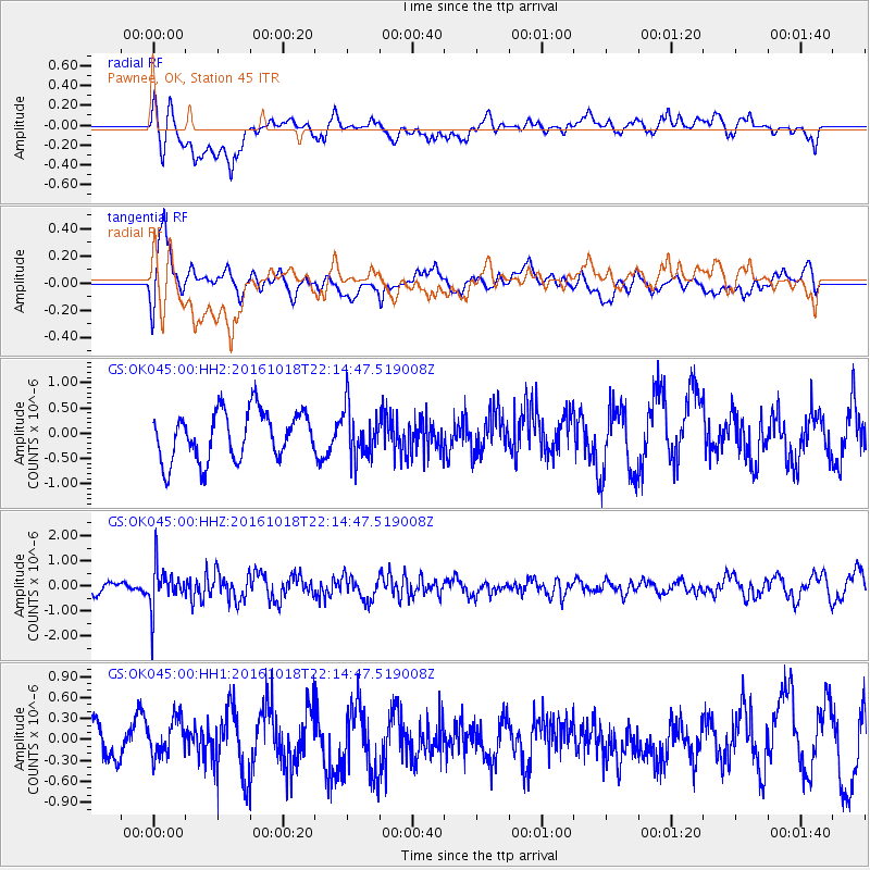
OK045 Pawnee, OK, Station 45 - Earthquake Result Viewer
*The percent match for this event was below the threshold and hence no stack was calculated.
| Earthquake location: |
Leeward Islands |
| Earthquake latitude/longitude: |
15.2/-61.5 |
| Earthquake time(UTC): |
2016/10/18 (292) 22:08:14 GMT |
| Earthquake Depth: |
143 km |
| Earthquake Magnitude: |
5.6 MWW, 5.6 MWB |
| Earthquake Catalog/Contributor: |
NEIC PDE/NEIC COMCAT |
|
| Network: |
GS US Geological Survey Networks |
| Station: |
OK045 Pawnee, OK, Station 45 |
| Lat/Lon: |
36.45 N/96.92 W |
| Elevation: |
284 m |
|
| Distance: |
37.9 deg |
| Az: |
310.535 deg |
| Baz: |
114.505 deg |
| Ray Param: |
$rayparam |
*The percent match for this event was below the threshold and hence was not used in the summary stack. |
|
| Radial Match: |
55.968616 % |
| Radial Bump: |
400 |
| Transverse Match: |
63.706646 % |
| Transverse Bump: |
400 |
| SOD ConfigId: |
1815711 |
| Insert Time: |
2016-11-01 22:11:01.726 +0000 |
| GWidth: |
2.5 |
| Max Bumps: |
400 |
| Tol: |
0.001 |
|
Signal To Noise
| Channel | StoN | STA | LTA |
| GS:OK045:00:HHZ:20161018T22:14:47.519008Z | 3.0658002 | 8.275667E-7 | 2.6993496E-7 |
| GS:OK045:00:HH1:20161018T22:14:47.519008Z | 0.6792012 | 2.7197814E-7 | 4.0043827E-7 |
| GS:OK045:00:HH2:20161018T22:14:47.519008Z | 1.0310043 | 4.9393867E-7 | 4.79085E-7 |
| Arrivals |
| Ps | |
| PpPs | |
| PsPs/PpSs | |


