You are here: Home > Network List > TS - TERRAscope (Southern California Seismic Network) Stations List
> Station DGR Domenigoni Valley Reservior, California, USA > Earthquake Result Viewer
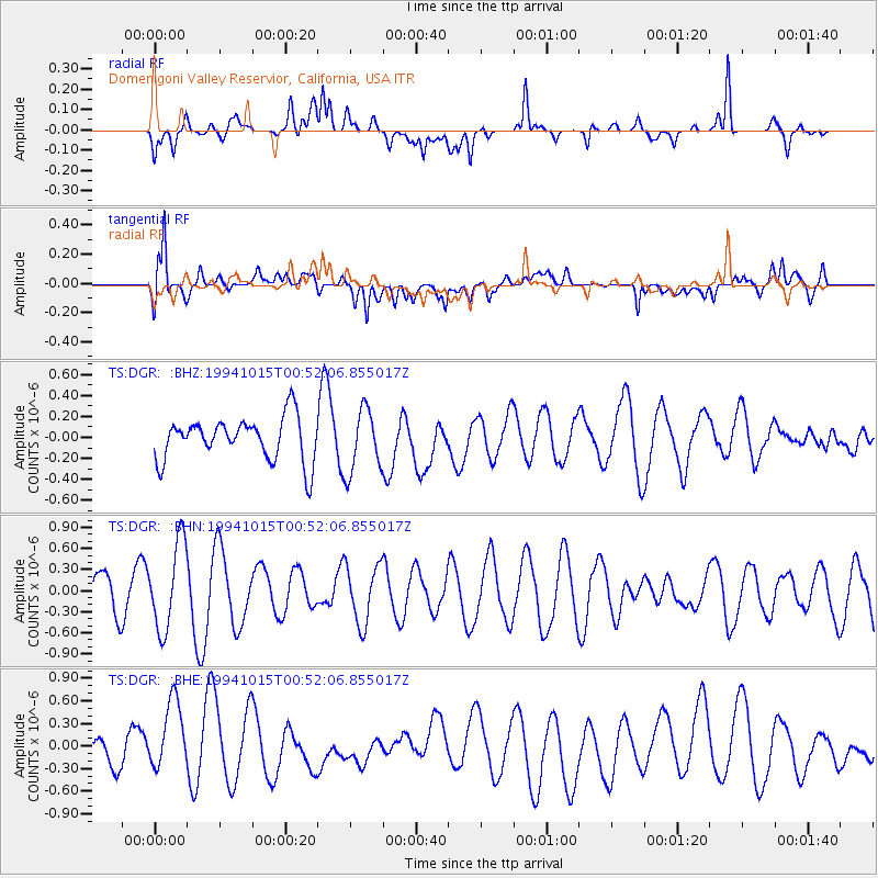
DGR Domenigoni Valley Reservior, California, USA - Earthquake Result Viewer
*The percent match for this event was below the threshold and hence no stack was calculated.
| Earthquake location: |
New Ireland Region, P.N.G. |
| Earthquake latitude/longitude: |
-3.8/152.1 |
| Earthquake time(UTC): |
1994/10/15 (288) 00:39:27 GMT |
| Earthquake Depth: |
24 km |
| Earthquake Magnitude: |
5.6 MB, 6.1 MS, 6.0 UNKNOWN, 6.2 MW |
| Earthquake Catalog/Contributor: |
WHDF/NEIC |
|
| Network: |
TS TERRAscope (Southern California Seismic Network) |
| Station: |
DGR Domenigoni Valley Reservior, California, USA |
| Lat/Lon: |
33.65 N/117.01 W |
| Elevation: |
700 m |
|
| Distance: |
92.8 deg |
| Az: |
56.622 deg |
| Baz: |
267.371 deg |
| Ray Param: |
$rayparam |
*The percent match for this event was below the threshold and hence was not used in the summary stack. |
|
| Radial Match: |
57.294758 % |
| Radial Bump: |
400 |
| Transverse Match: |
80.53024 % |
| Transverse Bump: |
400 |
| SOD ConfigId: |
4480 |
| Insert Time: |
2010-02-26 14:10:02.780 +0000 |
| GWidth: |
2.5 |
| Max Bumps: |
400 |
| Tol: |
0.001 |
|
Signal To Noise
| Channel | StoN | STA | LTA |
| TS:DGR: :BHN:19941015T00:52:06.855017Z | 1.8150058 | 6.171624E-7 | 3.400333E-7 |
| TS:DGR: :BHE:19941015T00:52:06.855017Z | 2.7283857 | 4.934862E-7 | 1.8087113E-7 |
| TS:DGR: :BHZ:19941015T00:52:06.855017Z | 1.4581236 | 2.9959907E-7 | 2.0546891E-7 |
| Arrivals |
| Ps | |
| PpPs | |
| PsPs/PpSs | |


