You are here: Home > Network List > TA - USArray Transportable Network (new EarthScope stations) Stations List
> Station S13A Holt Ranch, Enterprise, UT, USA > Earthquake Result Viewer
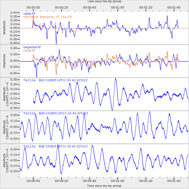
S13A Holt Ranch, Enterprise, UT, USA - Earthquake Result Viewer
*The percent match for this event was below the threshold and hence no stack was calculated.
| Earthquake location: |
Pacific-Antarctic Ridge |
| Earthquake latitude/longitude: |
-56.8/-142.3 |
| Earthquake time(UTC): |
2008/05/14 (135) 21:47:40 GMT |
| Earthquake Depth: |
10 km |
| Earthquake Magnitude: |
5.7 MW, 5.2 MS, 4.8 MB |
| Earthquake Catalog/Contributor: |
WHDF/NEIC |
|
| Network: |
TA USArray Transportable Network (new EarthScope stations) |
| Station: |
S13A Holt Ranch, Enterprise, UT, USA |
| Lat/Lon: |
37.58 N/113.86 W |
| Elevation: |
1698 m |
|
| Distance: |
97.0 deg |
| Az: |
22.416 deg |
| Baz: |
195.323 deg |
| Ray Param: |
$rayparam |
*The percent match for this event was below the threshold and hence was not used in the summary stack. |
|
| Radial Match: |
58.462765 % |
| Radial Bump: |
400 |
| Transverse Match: |
48.51083 % |
| Transverse Bump: |
400 |
| SOD ConfigId: |
2504 |
| Insert Time: |
2010-03-06 21:18:47.606 +0000 |
| GWidth: |
2.5 |
| Max Bumps: |
400 |
| Tol: |
0.001 |
|
Signal To Noise
| Channel | StoN | STA | LTA |
| TA:S13A: :BHN:20080514T22:00:40.42502Z | 1.971133 | 1.4045649E-7 | 7.125673E-8 |
| TA:S13A: :BHE:20080514T22:00:40.42502Z | 0.69940144 | 6.471729E-8 | 9.2532396E-8 |
| TA:S13A: :BHZ:20080514T22:00:40.42502Z | 2.1536565 | 1.5392118E-7 | 7.146969E-8 |
| Arrivals |
| Ps | |
| PpPs | |
| PsPs/PpSs | |


