You are here: Home > Network List > TA - USArray Transportable Network (new EarthScope stations) Stations List
> Station S13A Holt Ranch, Enterprise, UT, USA > Earthquake Result Viewer
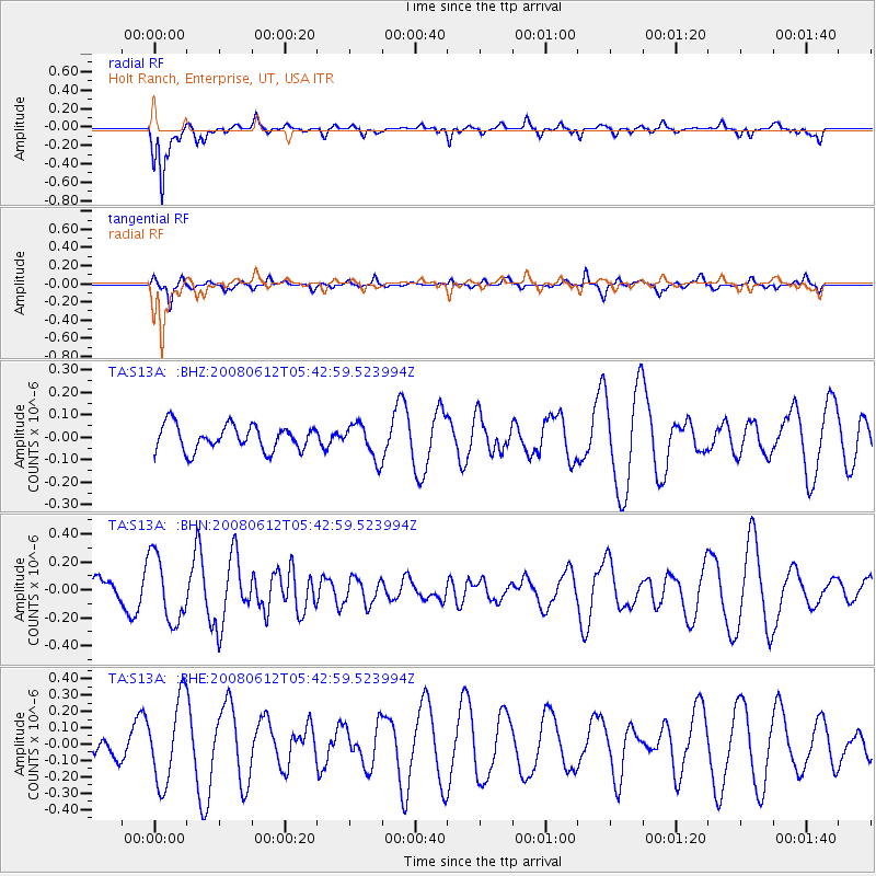
S13A Holt Ranch, Enterprise, UT, USA - Earthquake Result Viewer
*The percent match for this event was below the threshold and hence no stack was calculated.
| Earthquake location: |
Southern East Pacific Rise |
| Earthquake latitude/longitude: |
-50.2/-114.2 |
| Earthquake time(UTC): |
2008/06/12 (164) 05:30:43 GMT |
| Earthquake Depth: |
10 km |
| Earthquake Magnitude: |
5.6 MS, 5.3 MB, 5.9 MW, 5.9 MW |
| Earthquake Catalog/Contributor: |
WHDF/NEIC |
|
| Network: |
TA USArray Transportable Network (new EarthScope stations) |
| Station: |
S13A Holt Ranch, Enterprise, UT, USA |
| Lat/Lon: |
37.58 N/113.86 W |
| Elevation: |
1698 m |
|
| Distance: |
87.4 deg |
| Az: |
0.245 deg |
| Baz: |
180.199 deg |
| Ray Param: |
$rayparam |
*The percent match for this event was below the threshold and hence was not used in the summary stack. |
|
| Radial Match: |
75.12807 % |
| Radial Bump: |
302 |
| Transverse Match: |
37.06931 % |
| Transverse Bump: |
314 |
| SOD ConfigId: |
2504 |
| Insert Time: |
2010-03-06 21:18:52.074 +0000 |
| GWidth: |
2.5 |
| Max Bumps: |
400 |
| Tol: |
0.001 |
|
Signal To Noise
| Channel | StoN | STA | LTA |
| TA:S13A: :BHN:20080612T05:42:59.523994Z | 1.3831948 | 2.381195E-7 | 1.7215183E-7 |
| TA:S13A: :BHE:20080612T05:42:59.523994Z | 2.12013 | 2.5367612E-7 | 1.1965122E-7 |
| TA:S13A: :BHZ:20080612T05:42:59.523994Z | 1.3847626 | 7.7357655E-8 | 5.5863474E-8 |
| Arrivals |
| Ps | |
| PpPs | |
| PsPs/PpSs | |


