You are here: Home > Network List > IU - Global Seismograph Network (GSN - IRIS/USGS) Stations List
> Station WVT Waverly, Tennessee, USA > Earthquake Result Viewer
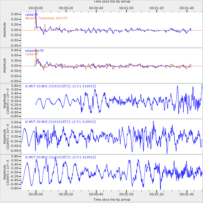
WVT Waverly, Tennessee, USA - Earthquake Result Viewer
*The percent match for this event was below the threshold and hence no stack was calculated.
| Earthquake location: |
Leeward Islands |
| Earthquake latitude/longitude: |
15.2/-61.5 |
| Earthquake time(UTC): |
2016/10/18 (292) 22:08:14 GMT |
| Earthquake Depth: |
143 km |
| Earthquake Magnitude: |
5.6 MWW, 5.6 MWB |
| Earthquake Catalog/Contributor: |
NEIC PDE/NEIC COMCAT |
|
| Network: |
IU Global Seismograph Network (GSN - IRIS/USGS) |
| Station: |
WVT Waverly, Tennessee, USA |
| Lat/Lon: |
36.13 N/87.83 W |
| Elevation: |
170 m |
|
| Distance: |
31.4 deg |
| Az: |
316.434 deg |
| Baz: |
124.734 deg |
| Ray Param: |
$rayparam |
*The percent match for this event was below the threshold and hence was not used in the summary stack. |
|
| Radial Match: |
57.383286 % |
| Radial Bump: |
400 |
| Transverse Match: |
73.06356 % |
| Transverse Bump: |
362 |
| SOD ConfigId: |
1815711 |
| Insert Time: |
2016-11-01 22:12:37.147 +0000 |
| GWidth: |
2.5 |
| Max Bumps: |
400 |
| Tol: |
0.001 |
|
Signal To Noise
| Channel | StoN | STA | LTA |
| IU:WVT:00:BHZ:20161018T22:13:51.419001Z | 1.2402115 | 2.845447E-7 | 2.2943242E-7 |
| IU:WVT:00:BH1:20161018T22:13:51.419001Z | 1.4167169 | 4.008922E-7 | 2.8297268E-7 |
| IU:WVT:00:BH2:20161018T22:13:51.419001Z | 1.9361689 | 3.1819886E-7 | 1.6434458E-7 |
| Arrivals |
| Ps | |
| PpPs | |
| PsPs/PpSs | |


