You are here: Home > Network List > IW - Intermountain West Stations List
> Station PLID Pearl Lake, Idaho, USA > Earthquake Result Viewer
PLID Pearl Lake, Idaho, USA - Earthquake Result Viewer
*The percent match for this event was below the threshold and hence no stack was calculated.
| Earthquake location: |
Leeward Islands |
| Earthquake latitude/longitude: |
15.2/-61.5 |
| Earthquake time(UTC): |
2016/10/18 (292) 22:08:14 GMT |
| Earthquake Depth: |
143 km |
| Earthquake Magnitude: |
5.6 MWW, 5.6 MWB |
| Earthquake Catalog/Contributor: |
NEIC PDE/NEIC COMCAT |
|
| Network: |
IW Intermountain West |
| Station: |
PLID Pearl Lake, Idaho, USA |
| Lat/Lon: |
45.09 N/116.00 W |
| Elevation: |
2164 m |
|
| Distance: |
54.4 deg |
| Az: |
314.868 deg |
| Baz: |
105.027 deg |
| Ray Param: |
$rayparam |
*The percent match for this event was below the threshold and hence was not used in the summary stack. |
|
| Radial Match: |
49.126873 % |
| Radial Bump: |
316 |
| Transverse Match: |
73.36819 % |
| Transverse Bump: |
357 |
| SOD ConfigId: |
1815711 |
| Insert Time: |
2016-11-01 22:12:47.461 +0000 |
| GWidth: |
2.5 |
| Max Bumps: |
400 |
| Tol: |
0.001 |
|
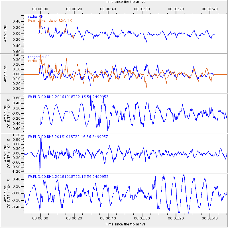
Signal To Noise
| Channel | StoN | STA | LTA |
| IW:PLID:00:BHZ:20161018T22:16:56.249995Z | 2.467048 | 4.4563564E-7 | 1.8063517E-7 |
| IW:PLID:00:BH1:20161018T22:16:56.249995Z | 0.85723484 | 2.5090247E-7 | 2.9268813E-7 |
| IW:PLID:00:BH2:20161018T22:16:56.249995Z | 1.6012517 | 3.6822928E-7 | 2.2996339E-7 |
| Arrivals |
| Ps | |
| PpPs | |
| PsPs/PpSs | |


