
V18A Ganado, AZ, USA - Earthquake Result Viewer
| ||||||||||||||||||
| ||||||||||||||||||
| ||||||||||||||||||
|
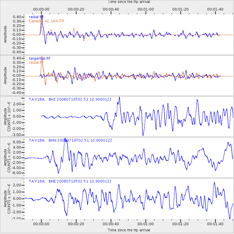
Signal To Noise
| Channel | StoN | STA | LTA |
| TA:V18A: :BHN:20080719T02:51:10.900012Z | 4.2459655 | 5.327539E-7 | 1.2547298E-7 |
| TA:V18A: :BHE:20080719T02:51:10.900012Z | 1.3939803 | 1.88365E-7 | 1.3512745E-7 |
| TA:V18A: :BHZ:20080719T02:51:10.900012Z | 1.4072845 | 1.6206397E-7 | 1.1516077E-7 |
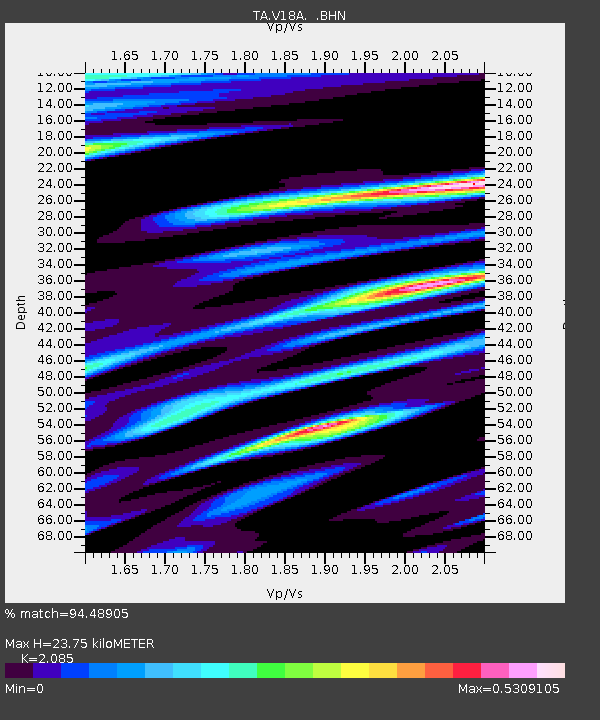
| Arrivals | |
| Ps | 4.1 SECOND |
| PpPs | 11 SECOND |
| PsPs/PpSs | 15 SECOND |

