You are here: Home > Network List > TA - USArray Transportable Network (new EarthScope stations) Stations List
> Station B18K Kokolik River, AK, USA > Earthquake Result Viewer
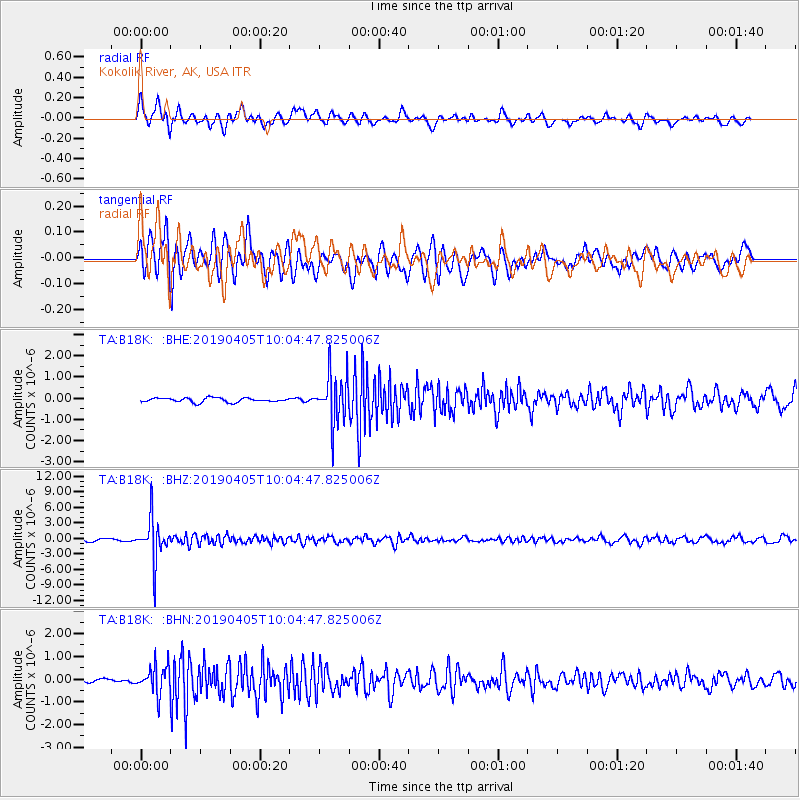
B18K Kokolik River, AK, USA - Earthquake Result Viewer
*The percent match for this event was below the threshold and hence no stack was calculated.
| Earthquake location: |
Southeast Of Honshu, Japan |
| Earthquake latitude/longitude: |
30.4/138.6 |
| Earthquake time(UTC): |
2019/04/05 (095) 09:56:53 GMT |
| Earthquake Depth: |
389 km |
| Earthquake Magnitude: |
5.8 Mww |
| Earthquake Catalog/Contributor: |
NEIC PDE/us |
|
| Network: |
TA USArray Transportable Network (new EarthScope stations) |
| Station: |
B18K Kokolik River, AK, USA |
| Lat/Lon: |
69.36 N/161.80 W |
| Elevation: |
222 m |
|
| Distance: |
51.2 deg |
| Az: |
23.09 deg |
| Baz: |
252.813 deg |
| Ray Param: |
$rayparam |
*The percent match for this event was below the threshold and hence was not used in the summary stack. |
|
| Radial Match: |
75.60532 % |
| Radial Bump: |
400 |
| Transverse Match: |
77.003136 % |
| Transverse Bump: |
400 |
| SOD ConfigId: |
13570011 |
| Insert Time: |
2019-05-02 21:21:20.511 +0000 |
| GWidth: |
2.5 |
| Max Bumps: |
400 |
| Tol: |
0.001 |
|
Signal To Noise
| Channel | StoN | STA | LTA |
| TA:B18K: :BHZ:20190405T10:04:47.825006Z | 19.793087 | 4.109341E-6 | 2.0761497E-7 |
| TA:B18K: :BHN:20190405T10:04:47.825006Z | 5.5816383 | 6.196617E-7 | 1.1101789E-7 |
| TA:B18K: :BHE:20190405T10:04:47.825006Z | 10.945673 | 1.0939855E-6 | 9.994684E-8 |
| Arrivals |
| Ps | |
| PpPs | |
| PsPs/PpSs | |


