You are here: Home > Network List > TA - USArray Transportable Network (new EarthScope stations) Stations List
> Station D23K Nanushuk River, AK USA > Earthquake Result Viewer
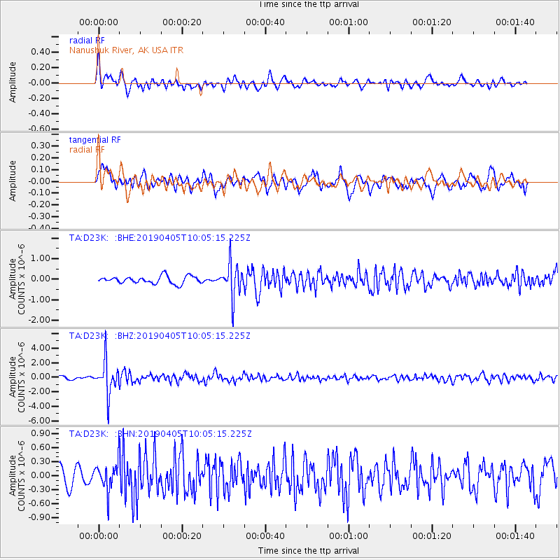
D23K Nanushuk River, AK USA - Earthquake Result Viewer
*The percent match for this event was below the threshold and hence no stack was calculated.
| Earthquake location: |
Southeast Of Honshu, Japan |
| Earthquake latitude/longitude: |
30.4/138.6 |
| Earthquake time(UTC): |
2019/04/05 (095) 09:56:53 GMT |
| Earthquake Depth: |
389 km |
| Earthquake Magnitude: |
5.8 Mww |
| Earthquake Catalog/Contributor: |
NEIC PDE/us |
|
| Network: |
TA USArray Transportable Network (new EarthScope stations) |
| Station: |
D23K Nanushuk River, AK USA |
| Lat/Lon: |
68.97 N/150.68 W |
| Elevation: |
406 m |
|
| Distance: |
55.0 deg |
| Az: |
24.573 deg |
| Baz: |
264.093 deg |
| Ray Param: |
$rayparam |
*The percent match for this event was below the threshold and hence was not used in the summary stack. |
|
| Radial Match: |
72.66338 % |
| Radial Bump: |
400 |
| Transverse Match: |
72.4559 % |
| Transverse Bump: |
400 |
| SOD ConfigId: |
13570011 |
| Insert Time: |
2019-05-02 21:21:32.506 +0000 |
| GWidth: |
2.5 |
| Max Bumps: |
400 |
| Tol: |
0.001 |
|
Signal To Noise
| Channel | StoN | STA | LTA |
| TA:D23K: :BHZ:20190405T10:05:15.225Z | 9.563704 | 2.3220116E-6 | 2.427942E-7 |
| TA:D23K: :BHN:20190405T10:05:15.225Z | 1.667464 | 3.193513E-7 | 1.9151916E-7 |
| TA:D23K: :BHE:20190405T10:05:15.225Z | 4.621555 | 8.224761E-7 | 1.7796523E-7 |
| Arrivals |
| Ps | |
| PpPs | |
| PsPs/PpSs | |


