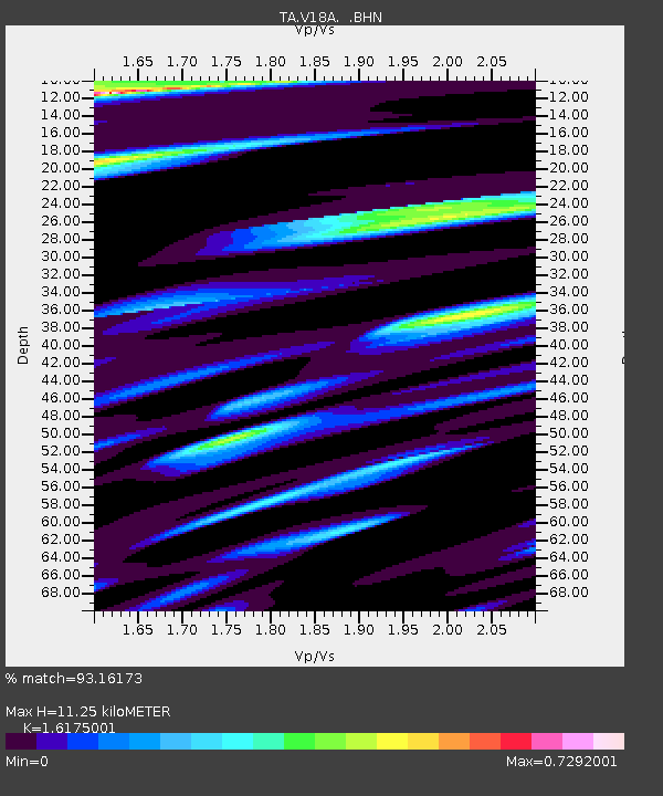
V18A Ganado, AZ, USA - Earthquake Result Viewer

Earthquake location: Near West Coast Of Honshu, Japan
Earthquake latitude/longitude: 37.5/138.4
Earthquake time(UTC): 2007/07/16 (197) 01:13:22 GMT
Earthquake Depth: 12 km
Earthquake Magnitude: 6.5 MB, 6.4 MS, 6.6 MW, 6.5 MW
Earthquake Catalog/Contributor: WHDF/NEIC
Network: TA USArray Transportable Network (new EarthScope stations)
Station: V18A Ganado, AZ, USA
Lat/Lon: 35.71 N/109.93 W
Elevation: 1977 m
Distance: 83.4 deg
Az: 49.6 deg
Baz: 311.937 deg
Ray Param: 0.04618018
Estimated Moho Depth: 11.25 km
Estimated Crust Vp/Vs: 1.62
Assumed Crust Vp: 6.496 km/s
Estimated Crust Vs: 4.016 km/s
Estimated Crust Poisson's Ratio: 0.19
Radial Match: 93.16173 %
Radial Bump: 347
Transverse Match: 92.527504 %
Transverse Bump: 400
SOD ConfigId: 2564
Insert Time: 2010-03-06 21:20:17.109 +0000
GWidth: 2.5
Max Bumps: 400
Tol: 0.001

Signal To Noise

ChannelStoNSTALTA
TA:V18A: :BHN:20070716T01:25:18.150029Z4.53763684.681641E-71.0317355E-7
TA:V18A: :BHE:20070716T01:25:18.150029Z7.410025.4027805E-77.2911824E-8
TA:V18A: :BHZ:20070716T01:25:18.150029Z41.310182.7163912E-66.575598E-8
Arrivals
Ps1.1 SECOND
PpPs4.4 SECOND
PsPs/PpSs5.5 SECOND