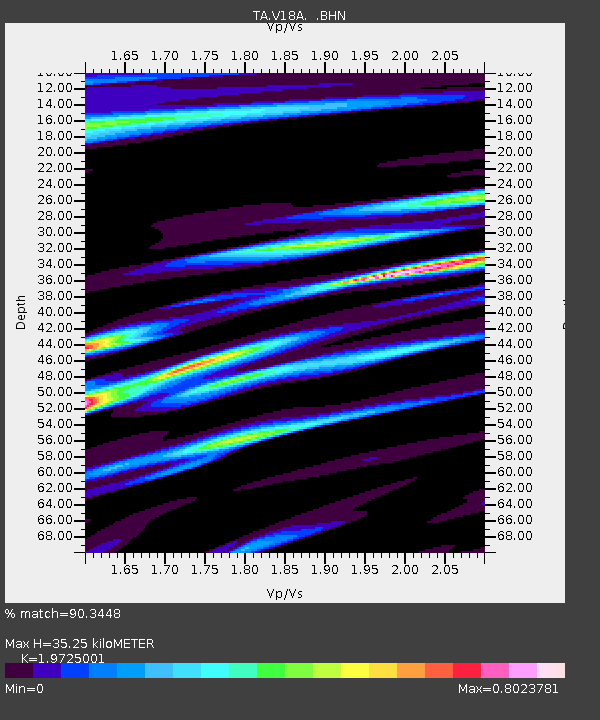
V18A Ganado, AZ, USA - Earthquake Result Viewer
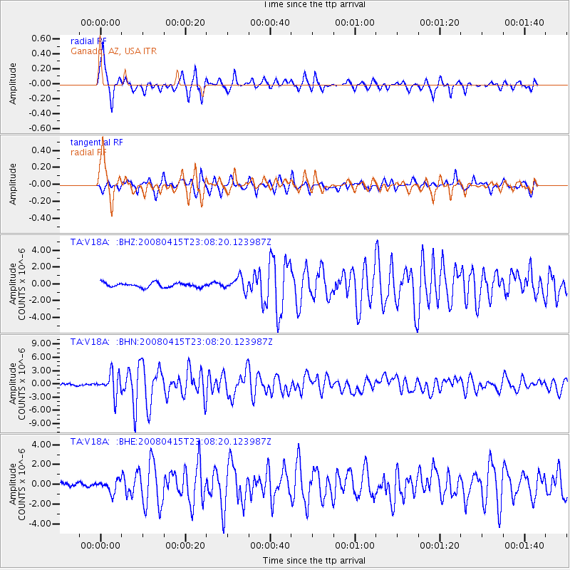
Earthquake location: Andreanof Islands, Aleutian Is.
Earthquake latitude/longitude: 51.9/-179.4
Earthquake time(UTC): 2008/04/15 (106) 22:59:51 GMT
Earthquake Depth: 10 km
Earthquake Magnitude: 6.1 MB, 6.4 MS, 6.4 MW, 6.4 MW
Earthquake Catalog/Contributor: WHDF/NEIC
Network: TA USArray Transportable Network (new EarthScope stations)
Station: V18A Ganado, AZ, USA
Lat/Lon: 35.71 N/109.93 W
Elevation: 1977 m
Distance: 50.7 deg
Az: 79.873 deg
Baz: 311.388 deg
Ray Param: 0.06787231
Estimated Moho Depth: 35.25 km
Estimated Crust Vp/Vs: 1.97
Assumed Crust Vp: 6.496 km/s
Estimated Crust Vs: 3.293 km/s
Estimated Crust Poisson's Ratio: 0.33
Radial Match: 90.3448 %
Radial Bump: 377
Transverse Match: 82.17247 %
Transverse Bump: 400
SOD ConfigId: 2504
Insert Time: 2010-03-06 21:20:28.603 +0000
GWidth: 2.5
Max Bumps: 400
Tol: 0.001

Signal To Noise

ChannelStoNSTALTA
TA:V18A: :BHN:20080415T23:08:20.123987Z12.9320952.5533122E-61.9743996E-7
TA:V18A: :BHE:20080415T23:08:20.123987Z2.83406076.093543E-72.1501101E-7
TA:V18A: :BHZ:20080415T23:08:20.123987Z3.13319028.0576467E-72.571707E-7
Arrivals
Ps5.6 SECOND
PpPs15 SECOND
PsPs/PpSs21 SECOND