You are here: Home > Network List > TA - USArray Transportable Network (new EarthScope stations) Stations List
> Station V18A Ganado, AZ, USA > Earthquake Result Viewer
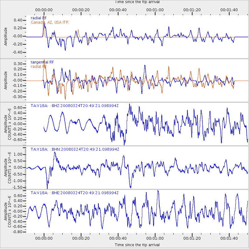
V18A Ganado, AZ, USA - Earthquake Result Viewer
*The percent match for this event was below the threshold and hence no stack was calculated.
| Earthquake location: |
Chile-Bolivia Border Region |
| Earthquake latitude/longitude: |
-20.0/-69.0 |
| Earthquake time(UTC): |
2008/03/24 (084) 20:39:07 GMT |
| Earthquake Depth: |
120 km |
| Earthquake Magnitude: |
5.7 MB, 6.2 MW, 6.1 MW |
| Earthquake Catalog/Contributor: |
WHDF/NEIC |
|
| Network: |
TA USArray Transportable Network (new EarthScope stations) |
| Station: |
V18A Ganado, AZ, USA |
| Lat/Lon: |
35.71 N/109.93 W |
| Elevation: |
1977 m |
|
| Distance: |
67.7 deg |
| Az: |
324.775 deg |
| Baz: |
138.214 deg |
| Ray Param: |
$rayparam |
*The percent match for this event was below the threshold and hence was not used in the summary stack. |
|
| Radial Match: |
64.694954 % |
| Radial Bump: |
400 |
| Transverse Match: |
55.875694 % |
| Transverse Bump: |
400 |
| SOD ConfigId: |
2504 |
| Insert Time: |
2010-03-06 21:20:46.855 +0000 |
| GWidth: |
2.5 |
| Max Bumps: |
400 |
| Tol: |
0.001 |
|
Signal To Noise
| Channel | StoN | STA | LTA |
| TA:V18A: :BHN:20080324T20:49:21.098994Z | 8.572811 | 5.7419334E-7 | 6.697842E-8 |
| TA:V18A: :BHE:20080324T20:49:21.098994Z | 1.5218761 | 2.8506423E-7 | 1.8731107E-7 |
| TA:V18A: :BHZ:20080324T20:49:21.098994Z | 0.8932534 | 1.781825E-7 | 1.9947588E-7 |
| Arrivals |
| Ps | |
| PpPs | |
| PsPs/PpSs | |


