You are here: Home > Network List > TS - TERRAscope (Southern California Seismic Network) Stations List
> Station DGR Domenigoni Valley Reservior, California, USA > Earthquake Result Viewer
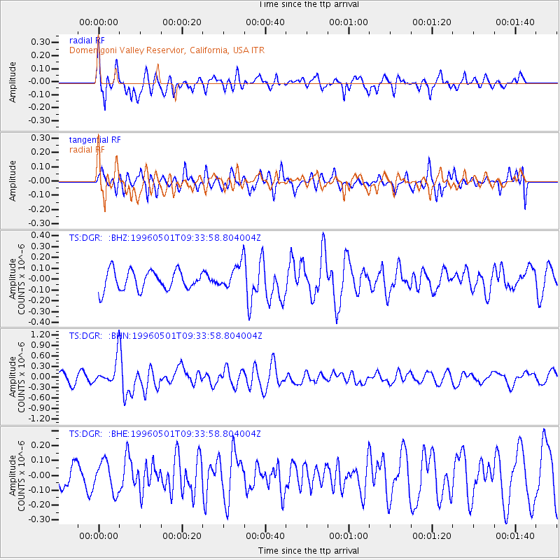
DGR Domenigoni Valley Reservior, California, USA - Earthquake Result Viewer
*The percent match for this event was below the threshold and hence no stack was calculated.
| Earthquake location: |
Solomon Islands |
| Earthquake latitude/longitude: |
-6.7/154.8 |
| Earthquake time(UTC): |
1996/05/01 (122) 09:21:24 GMT |
| Earthquake Depth: |
33 km |
| Earthquake Magnitude: |
5.5 MB, 5.9 MS, 6.0 UNKNOWN, 5.9 MW |
| Earthquake Catalog/Contributor: |
WHDF/NEIC |
|
| Network: |
TS TERRAscope (Southern California Seismic Network) |
| Station: |
DGR Domenigoni Valley Reservior, California, USA |
| Lat/Lon: |
33.65 N/117.01 W |
| Elevation: |
700 m |
|
| Distance: |
92.1 deg |
| Az: |
56.54 deg |
| Baz: |
263.459 deg |
| Ray Param: |
$rayparam |
*The percent match for this event was below the threshold and hence was not used in the summary stack. |
|
| Radial Match: |
71.51717 % |
| Radial Bump: |
400 |
| Transverse Match: |
55.19494 % |
| Transverse Bump: |
400 |
| SOD ConfigId: |
4480 |
| Insert Time: |
2010-02-26 14:10:09.047 +0000 |
| GWidth: |
2.5 |
| Max Bumps: |
400 |
| Tol: |
0.001 |
|
Signal To Noise
| Channel | StoN | STA | LTA |
| TS:DGR: :BHN:19960501T09:33:58.804004Z | 3.1691933 | 4.0199933E-7 | 1.2684596E-7 |
| TS:DGR: :BHE:19960501T09:33:58.804004Z | 0.7662708 | 1.04167704E-7 | 1.3594111E-7 |
| TS:DGR: :BHZ:19960501T09:33:58.804004Z | 1.3765787 | 1.2367231E-7 | 8.984035E-8 |
| Arrivals |
| Ps | |
| PpPs | |
| PsPs/PpSs | |


