You are here: Home > Network List > TA - USArray Transportable Network (new EarthScope stations) Stations List
> Station V18A Ganado, AZ, USA > Earthquake Result Viewer
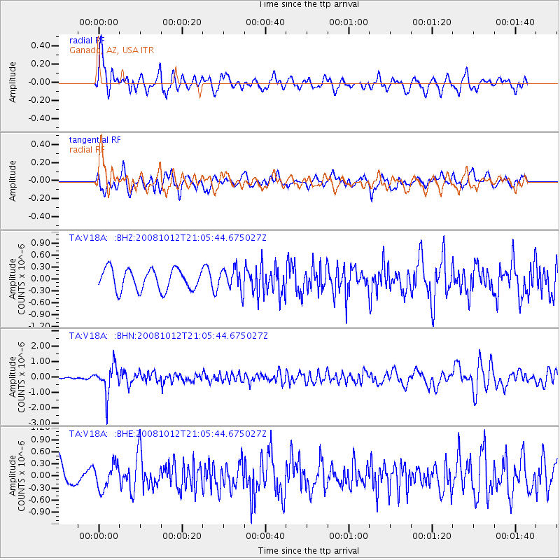
V18A Ganado, AZ, USA - Earthquake Result Viewer
*The percent match for this event was below the threshold and hence no stack was calculated.
| Earthquake location: |
Southern Bolivia |
| Earthquake latitude/longitude: |
-20.1/-65.0 |
| Earthquake time(UTC): |
2008/10/12 (286) 20:55:41 GMT |
| Earthquake Depth: |
353 km |
| Earthquake Magnitude: |
6.0 MB, 6.2 MW, 6.2 MW |
| Earthquake Catalog/Contributor: |
WHDF/NEIC |
|
| Network: |
TA USArray Transportable Network (new EarthScope stations) |
| Station: |
V18A Ganado, AZ, USA |
| Lat/Lon: |
35.71 N/109.93 W |
| Elevation: |
1977 m |
|
| Distance: |
70.0 deg |
| Az: |
322.261 deg |
| Baz: |
135.03 deg |
| Ray Param: |
$rayparam |
*The percent match for this event was below the threshold and hence was not used in the summary stack. |
|
| Radial Match: |
59.78884 % |
| Radial Bump: |
400 |
| Transverse Match: |
44.797657 % |
| Transverse Bump: |
400 |
| SOD ConfigId: |
2556 |
| Insert Time: |
2010-03-06 21:21:10.249 +0000 |
| GWidth: |
2.5 |
| Max Bumps: |
400 |
| Tol: |
0.001 |
|
Signal To Noise
| Channel | StoN | STA | LTA |
| TA:V18A: :BHN:20081012T21:05:44.675027Z | 7.6758814 | 9.116978E-7 | 1.18774345E-7 |
| TA:V18A: :BHE:20081012T21:05:44.675027Z | 0.9155631 | 3.1403835E-7 | 3.430002E-7 |
| TA:V18A: :BHZ:20081012T21:05:44.675027Z | 1.0796536 | 2.8376627E-7 | 2.6283084E-7 |
| Arrivals |
| Ps | |
| PpPs | |
| PsPs/PpSs | |


