You are here: Home > Network List > TA - USArray Transportable Network (new EarthScope stations) Stations List
> Station V18A Ganado, AZ, USA > Earthquake Result Viewer
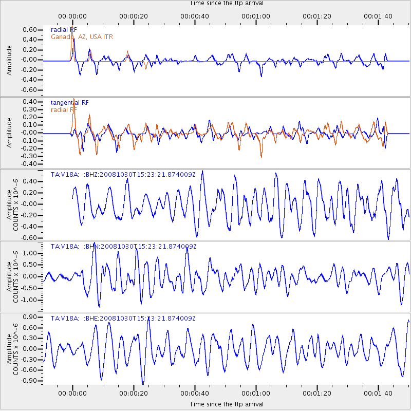
V18A Ganado, AZ, USA - Earthquake Result Viewer
*The percent match for this event was below the threshold and hence no stack was calculated.
| Earthquake location: |
Central East Pacific Rise |
| Earthquake latitude/longitude: |
-9.0/-108.2 |
| Earthquake time(UTC): |
2008/10/30 (304) 15:15:41 GMT |
| Earthquake Depth: |
10 km |
| Earthquake Magnitude: |
5.5 MB, 5.8 MS, 6.0 MW, 6.0 MW |
| Earthquake Catalog/Contributor: |
WHDF/NEIC |
|
| Network: |
TA USArray Transportable Network (new EarthScope stations) |
| Station: |
V18A Ganado, AZ, USA |
| Lat/Lon: |
35.71 N/109.93 W |
| Elevation: |
1977 m |
|
| Distance: |
44.5 deg |
| Az: |
358.042 deg |
| Baz: |
177.623 deg |
| Ray Param: |
$rayparam |
*The percent match for this event was below the threshold and hence was not used in the summary stack. |
|
| Radial Match: |
76.5751 % |
| Radial Bump: |
400 |
| Transverse Match: |
63.479786 % |
| Transverse Bump: |
400 |
| SOD ConfigId: |
2560 |
| Insert Time: |
2010-03-06 21:21:20.460 +0000 |
| GWidth: |
2.5 |
| Max Bumps: |
400 |
| Tol: |
0.001 |
|
Signal To Noise
| Channel | StoN | STA | LTA |
| TA:V18A: :BHN:20081030T15:23:21.874009Z | 2.5682778 | 3.1023913E-7 | 1.2079656E-7 |
| TA:V18A: :BHE:20081030T15:23:21.874009Z | 0.61142606 | 1.5679709E-7 | 2.5644488E-7 |
| TA:V18A: :BHZ:20081030T15:23:21.874009Z | 0.8325951 | 1.6986489E-7 | 2.040186E-7 |
| Arrivals |
| Ps | |
| PpPs | |
| PsPs/PpSs | |


