You are here: Home > Network List > TA - USArray Transportable Network (new EarthScope stations) Stations List
> Station V18A Ganado, AZ, USA > Earthquake Result Viewer
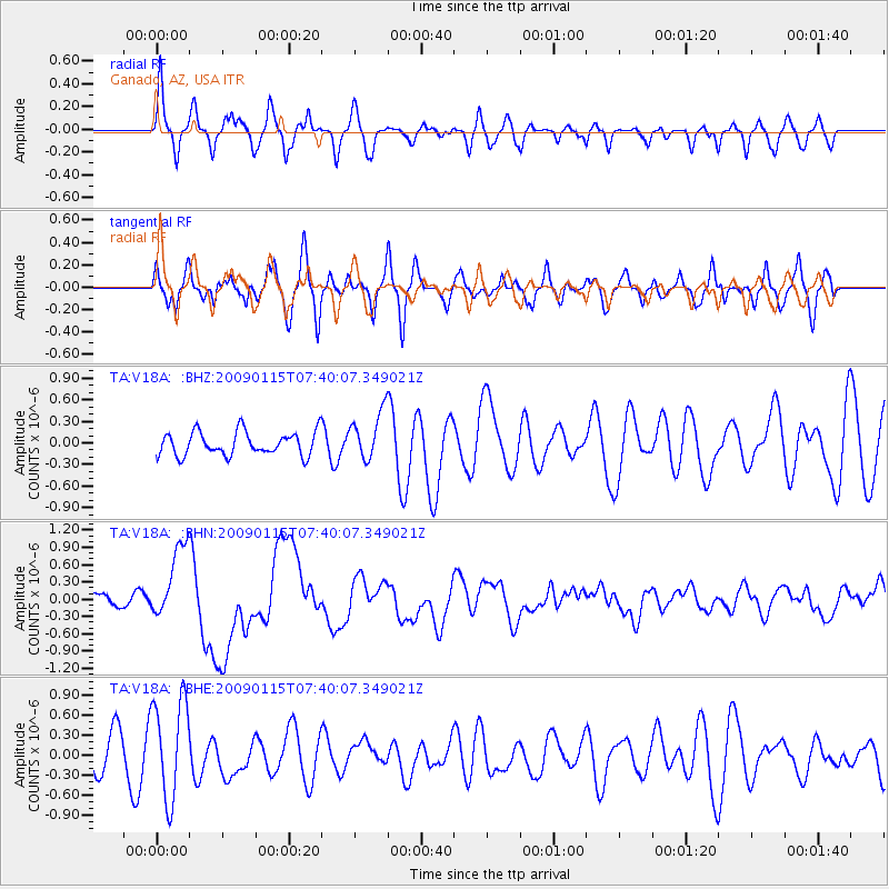
V18A Ganado, AZ, USA - Earthquake Result Viewer
*The percent match for this event was below the threshold and hence no stack was calculated.
| Earthquake location: |
Southeast Of Loyalty Islands |
| Earthquake latitude/longitude: |
-22.4/170.6 |
| Earthquake time(UTC): |
2009/01/15 (015) 07:27:20 GMT |
| Earthquake Depth: |
27 km |
| Earthquake Magnitude: |
5.8 MB, 6.5 MS, 6.7 MW, 6.6 MW |
| Earthquake Catalog/Contributor: |
WHDF/NEIC |
|
| Network: |
TA USArray Transportable Network (new EarthScope stations) |
| Station: |
V18A Ganado, AZ, USA |
| Lat/Lon: |
35.71 N/109.93 W |
| Elevation: |
1977 m |
|
| Distance: |
94.7 deg |
| Az: |
53.388 deg |
| Baz: |
245.937 deg |
| Ray Param: |
$rayparam |
*The percent match for this event was below the threshold and hence was not used in the summary stack. |
|
| Radial Match: |
55.083546 % |
| Radial Bump: |
400 |
| Transverse Match: |
61.97478 % |
| Transverse Bump: |
400 |
| SOD ConfigId: |
2834 |
| Insert Time: |
2010-03-06 21:21:21.248 +0000 |
| GWidth: |
2.5 |
| Max Bumps: |
400 |
| Tol: |
0.001 |
|
Signal To Noise
| Channel | StoN | STA | LTA |
| TA:V18A: :BHN:20090115T07:40:07.349021Z | 4.913628 | 6.4915923E-7 | 1.3211402E-7 |
| TA:V18A: :BHE:20090115T07:40:07.349021Z | 3.5792482 | 7.4167576E-7 | 2.072155E-7 |
| TA:V18A: :BHZ:20090115T07:40:07.349021Z | 2.067465 | 3.3811904E-7 | 1.6354281E-7 |
| Arrivals |
| Ps | |
| PpPs | |
| PsPs/PpSs | |


