You are here: Home > Network List > TS - TERRAscope (Southern California Seismic Network) Stations List
> Station DGR Domenigoni Valley Reservior, California, USA > Earthquake Result Viewer
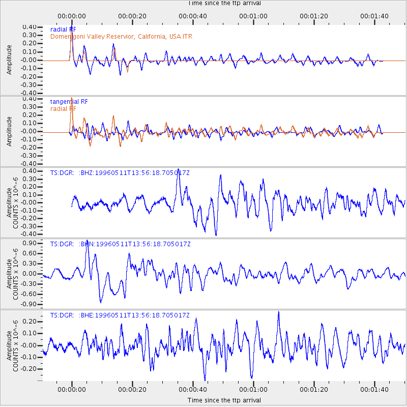
DGR Domenigoni Valley Reservior, California, USA - Earthquake Result Viewer
*The percent match for this event was below the threshold and hence no stack was calculated.
| Earthquake location: |
Solomon Islands |
| Earthquake latitude/longitude: |
-6.6/155.0 |
| Earthquake time(UTC): |
1996/05/11 (132) 13:43:45 GMT |
| Earthquake Depth: |
33 km |
| Earthquake Magnitude: |
5.7 MB, 6.3 MS, 6.4 UNKNOWN, 6.3 MW |
| Earthquake Catalog/Contributor: |
WHDF/NEIC |
|
| Network: |
TS TERRAscope (Southern California Seismic Network) |
| Station: |
DGR Domenigoni Valley Reservior, California, USA |
| Lat/Lon: |
33.65 N/117.01 W |
| Elevation: |
700 m |
|
| Distance: |
91.9 deg |
| Az: |
56.52 deg |
| Baz: |
263.399 deg |
| Ray Param: |
$rayparam |
*The percent match for this event was below the threshold and hence was not used in the summary stack. |
|
| Radial Match: |
79.578285 % |
| Radial Bump: |
400 |
| Transverse Match: |
62.25066 % |
| Transverse Bump: |
400 |
| SOD ConfigId: |
4480 |
| Insert Time: |
2010-02-26 14:10:10.952 +0000 |
| GWidth: |
2.5 |
| Max Bumps: |
400 |
| Tol: |
0.001 |
|
Signal To Noise
| Channel | StoN | STA | LTA |
| TS:DGR: :BHN:19960511T13:56:18.705017Z | 2.4913273 | 2.3475623E-7 | 9.4229385E-8 |
| TS:DGR: :BHE:19960511T13:56:18.705017Z | 0.90433604 | 6.3599465E-8 | 7.032725E-8 |
| TS:DGR: :BHZ:19960511T13:56:18.705017Z | 1.7509183 | 9.585557E-8 | 5.4745886E-8 |
| Arrivals |
| Ps | |
| PpPs | |
| PsPs/PpSs | |


