You are here: Home > Network List > TA - USArray Transportable Network (new EarthScope stations) Stations List
> Station G21K Allakaket, AK, USA > Earthquake Result Viewer
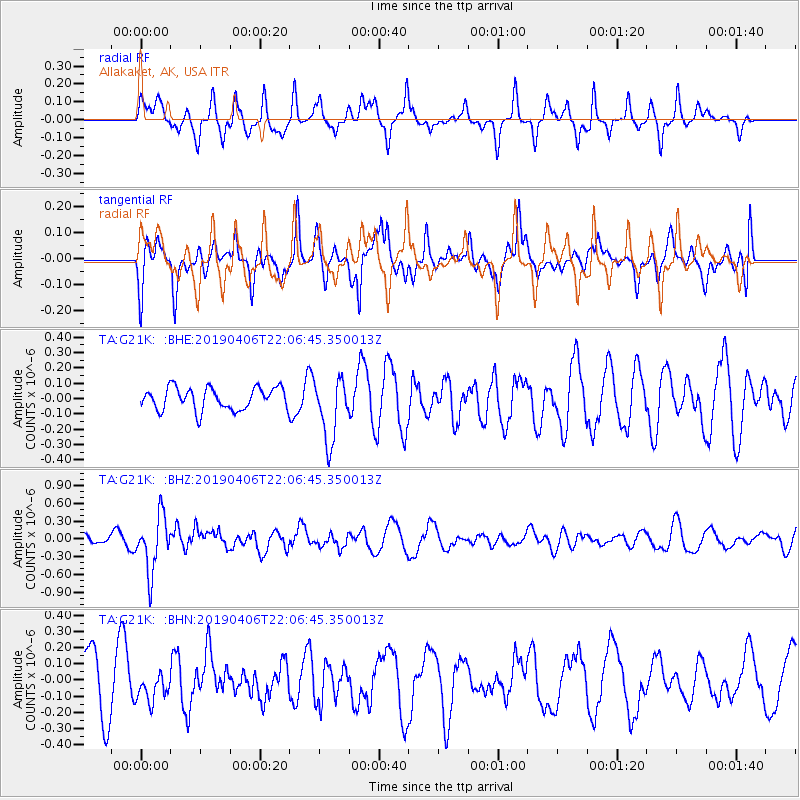
G21K Allakaket, AK, USA - Earthquake Result Viewer
*The percent match for this event was below the threshold and hence no stack was calculated.
| Earthquake location: |
Banda Sea |
| Earthquake latitude/longitude: |
-6.8/125.0 |
| Earthquake time(UTC): |
2019/04/06 (096) 21:55:01 GMT |
| Earthquake Depth: |
539 km |
| Earthquake Magnitude: |
6.3 Mww |
| Earthquake Catalog/Contributor: |
NEIC PDE/us |
|
| Network: |
TA USArray Transportable Network (new EarthScope stations) |
| Station: |
G21K Allakaket, AK, USA |
| Lat/Lon: |
66.52 N/153.51 W |
| Elevation: |
446 m |
|
| Distance: |
92.8 deg |
| Az: |
23.38 deg |
| Baz: |
259.486 deg |
| Ray Param: |
$rayparam |
*The percent match for this event was below the threshold and hence was not used in the summary stack. |
|
| Radial Match: |
62.36349 % |
| Radial Bump: |
343 |
| Transverse Match: |
61.198475 % |
| Transverse Bump: |
393 |
| SOD ConfigId: |
13570011 |
| Insert Time: |
2019-05-02 21:38:39.072 +0000 |
| GWidth: |
2.5 |
| Max Bumps: |
400 |
| Tol: |
0.001 |
|
Signal To Noise
| Channel | StoN | STA | LTA |
| TA:G21K: :BHZ:20190406T22:06:45.350013Z | 5.220057 | 4.6837283E-7 | 8.972562E-8 |
| TA:G21K: :BHN:20190406T22:06:45.350013Z | 0.6561518 | 9.126236E-8 | 1.3908726E-7 |
| TA:G21K: :BHE:20190406T22:06:45.350013Z | 2.832679 | 2.0403814E-7 | 7.20301E-8 |
| Arrivals |
| Ps | |
| PpPs | |
| PsPs/PpSs | |


