You are here: Home > Network List > TA - USArray Transportable Network (new EarthScope stations) Stations List
> Station O17K Koliganek, Bristol Bay, AK, USA > Earthquake Result Viewer
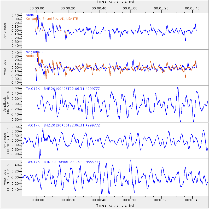
O17K Koliganek, Bristol Bay, AK, USA - Earthquake Result Viewer
*The percent match for this event was below the threshold and hence no stack was calculated.
| Earthquake location: |
Banda Sea |
| Earthquake latitude/longitude: |
-6.8/125.0 |
| Earthquake time(UTC): |
2019/04/06 (096) 21:55:01 GMT |
| Earthquake Depth: |
539 km |
| Earthquake Magnitude: |
6.3 Mww |
| Earthquake Catalog/Contributor: |
NEIC PDE/us |
|
| Network: |
TA USArray Transportable Network (new EarthScope stations) |
| Station: |
O17K Koliganek, Bristol Bay, AK, USA |
| Lat/Lon: |
59.77 N/157.09 W |
| Elevation: |
156 m |
|
| Distance: |
89.8 deg |
| Az: |
29.65 deg |
| Baz: |
256.137 deg |
| Ray Param: |
$rayparam |
*The percent match for this event was below the threshold and hence was not used in the summary stack. |
|
| Radial Match: |
60.589264 % |
| Radial Bump: |
400 |
| Transverse Match: |
55.697124 % |
| Transverse Bump: |
400 |
| SOD ConfigId: |
13570011 |
| Insert Time: |
2019-05-02 21:39:11.089 +0000 |
| GWidth: |
2.5 |
| Max Bumps: |
400 |
| Tol: |
0.001 |
|
Signal To Noise
| Channel | StoN | STA | LTA |
| TA:O17K: :BHZ:20190406T22:06:31.499977Z | 2.7000186 | 5.4552197E-7 | 2.0204378E-7 |
| TA:O17K: :BHN:20190406T22:06:31.499977Z | 1.0780123 | 1.9867576E-7 | 1.8429822E-7 |
| TA:O17K: :BHE:20190406T22:06:31.499977Z | 1.4376963 | 2.9903336E-7 | 2.079948E-7 |
| Arrivals |
| Ps | |
| PpPs | |
| PsPs/PpSs | |


