You are here: Home > Network List > TA - USArray Transportable Network (new EarthScope stations) Stations List
> Station P16A Fountain Green, UT, USA > Earthquake Result Viewer
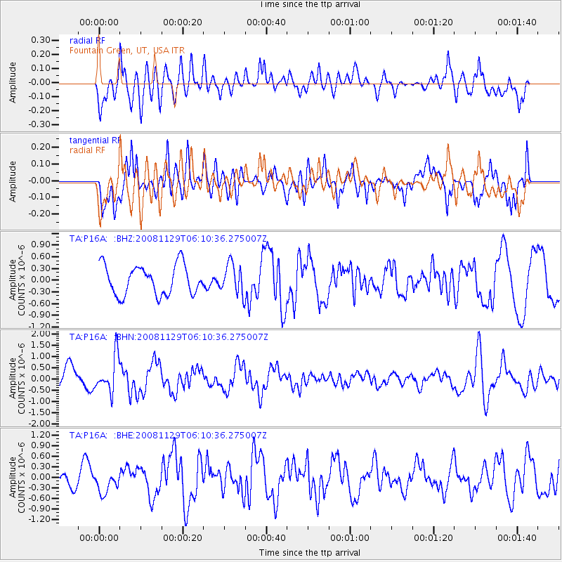
P16A Fountain Green, UT, USA - Earthquake Result Viewer
*The percent match for this event was below the threshold and hence no stack was calculated.
| Earthquake location: |
Fiji Islands Region |
| Earthquake latitude/longitude: |
-18.7/-177.7 |
| Earthquake time(UTC): |
2008/11/29 (334) 05:59:16 GMT |
| Earthquake Depth: |
386 km |
| Earthquake Magnitude: |
5.7 MB, 6.0 MW, 5.9 MW |
| Earthquake Catalog/Contributor: |
WHDF/NEIC |
|
| Network: |
TA USArray Transportable Network (new EarthScope stations) |
| Station: |
P16A Fountain Green, UT, USA |
| Lat/Lon: |
39.61 N/111.66 W |
| Elevation: |
1822 m |
|
| Distance: |
84.6 deg |
| Az: |
45.172 deg |
| Baz: |
240.483 deg |
| Ray Param: |
$rayparam |
*The percent match for this event was below the threshold and hence was not used in the summary stack. |
|
| Radial Match: |
70.36345 % |
| Radial Bump: |
400 |
| Transverse Match: |
60.677826 % |
| Transverse Bump: |
400 |
| SOD ConfigId: |
2658 |
| Insert Time: |
2010-03-06 21:23:20.761 +0000 |
| GWidth: |
2.5 |
| Max Bumps: |
400 |
| Tol: |
0.001 |
|
Signal To Noise
| Channel | StoN | STA | LTA |
| TA:P16A: :BHN:20081129T06:10:36.275007Z | 1.9364682 | 8.0391806E-7 | 4.151465E-7 |
| TA:P16A: :BHE:20081129T06:10:36.275007Z | 0.47111526 | 2.934292E-7 | 6.228395E-7 |
| TA:P16A: :BHZ:20081129T06:10:36.275007Z | 1.0415809 | 3.9591984E-7 | 3.8011433E-7 |
| Arrivals |
| Ps | |
| PpPs | |
| PsPs/PpSs | |


