You are here: Home > Network List > G - GEOSCOPE Stations List
> Station INU Inuyama, Japan > Earthquake Result Viewer
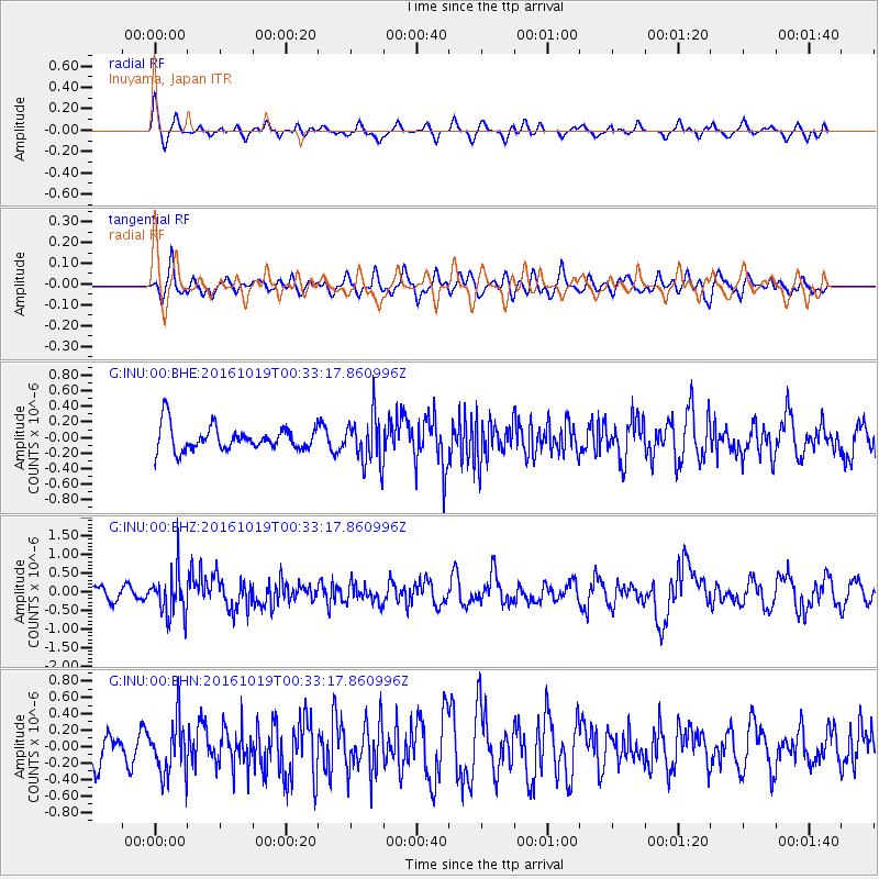
INU Inuyama, Japan - Earthquake Result Viewer
*The percent match for this event was below the threshold and hence no stack was calculated.
| Earthquake location: |
Java Sea |
| Earthquake latitude/longitude: |
-4.9/108.2 |
| Earthquake time(UTC): |
2016/10/19 (293) 00:26:01 GMT |
| Earthquake Depth: |
614 km |
| Earthquake Magnitude: |
6.6 MWW, 6.6 MWC, 6.7 MWB |
| Earthquake Catalog/Contributor: |
NEIC PDE/NEIC COMCAT |
|
| Network: |
G GEOSCOPE |
| Station: |
INU Inuyama, Japan |
| Lat/Lon: |
35.35 N/137.03 E |
| Elevation: |
132 m |
|
| Distance: |
48.3 deg |
| Az: |
31.892 deg |
| Baz: |
220.091 deg |
| Ray Param: |
$rayparam |
*The percent match for this event was below the threshold and hence was not used in the summary stack. |
|
| Radial Match: |
54.242508 % |
| Radial Bump: |
347 |
| Transverse Match: |
39.285343 % |
| Transverse Bump: |
400 |
| SOD ConfigId: |
1815711 |
| Insert Time: |
2016-11-02 00:26:23.556 +0000 |
| GWidth: |
2.5 |
| Max Bumps: |
400 |
| Tol: |
0.001 |
|
Signal To Noise
| Channel | StoN | STA | LTA |
| G:INU:00:BHZ:20161019T00:33:17.860996Z | 3.41924 | 5.877333E-7 | 1.7189005E-7 |
| G:INU:00:BHN:20161019T00:33:17.860996Z | 1.2071602 | 3.3753452E-7 | 2.7961036E-7 |
| G:INU:00:BHE:20161019T00:33:17.860996Z | 1.9720751 | 3.0851228E-7 | 1.5644044E-7 |
| Arrivals |
| Ps | |
| PpPs | |
| PsPs/PpSs | |


