You are here: Home > Network List > TA - USArray Transportable Network (new EarthScope stations) Stations List
> Station P16A Fountain Green, UT, USA > Earthquake Result Viewer
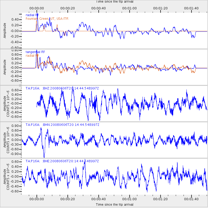
P16A Fountain Green, UT, USA - Earthquake Result Viewer
*The percent match for this event was below the threshold and hence no stack was calculated.
| Earthquake location: |
Northern Algeria |
| Earthquake latitude/longitude: |
35.9/-0.7 |
| Earthquake time(UTC): |
2008/06/06 (158) 20:02:56 GMT |
| Earthquake Depth: |
4.0 km |
| Earthquake Magnitude: |
5.5 MB, 5.3 MS, 5.5 MW, 5.5 MW |
| Earthquake Catalog/Contributor: |
WHDF/NEIC |
|
| Network: |
TA USArray Transportable Network (new EarthScope stations) |
| Station: |
P16A Fountain Green, UT, USA |
| Lat/Lon: |
39.61 N/111.66 W |
| Elevation: |
1822 m |
|
| Distance: |
81.6 deg |
| Az: |
313.2 deg |
| Baz: |
50.024 deg |
| Ray Param: |
$rayparam |
*The percent match for this event was below the threshold and hence was not used in the summary stack. |
|
| Radial Match: |
60.974117 % |
| Radial Bump: |
400 |
| Transverse Match: |
63.49957 % |
| Transverse Bump: |
400 |
| SOD ConfigId: |
2504 |
| Insert Time: |
2010-03-06 21:23:50.175 +0000 |
| GWidth: |
2.5 |
| Max Bumps: |
400 |
| Tol: |
0.001 |
|
Signal To Noise
| Channel | StoN | STA | LTA |
| TA:P16A: :BHN:20080606T20:14:44.548997Z | 2.4754453 | 4.6346977E-7 | 1.8722683E-7 |
| TA:P16A: :BHE:20080606T20:14:44.548997Z | 0.76127386 | 1.7864839E-7 | 2.3467034E-7 |
| TA:P16A: :BHZ:20080606T20:14:44.548997Z | 1.1749787 | 3.639001E-7 | 3.0970784E-7 |
| Arrivals |
| Ps | |
| PpPs | |
| PsPs/PpSs | |


