You are here: Home > Network List > TA - USArray Transportable Network (new EarthScope stations) Stations List
> Station P16A Fountain Green, UT, USA > Earthquake Result Viewer
P16A Fountain Green, UT, USA - Earthquake Result Viewer
*The percent match for this event was below the threshold and hence no stack was calculated.
| Earthquake location: |
Kuril Islands |
| Earthquake latitude/longitude: |
46.7/152.5 |
| Earthquake time(UTC): |
2008/08/27 (240) 05:24:41 GMT |
| Earthquake Depth: |
65 km |
| Earthquake Magnitude: |
5.5 MB, 5.4 MW, 5.3 MW |
| Earthquake Catalog/Contributor: |
WHDF/NEIC |
|
| Network: |
TA USArray Transportable Network (new EarthScope stations) |
| Station: |
P16A Fountain Green, UT, USA |
| Lat/Lon: |
39.61 N/111.66 W |
| Elevation: |
1822 m |
|
| Distance: |
66.0 deg |
| Az: |
57.263 deg |
| Baz: |
311.49 deg |
| Ray Param: |
$rayparam |
*The percent match for this event was below the threshold and hence was not used in the summary stack. |
|
| Radial Match: |
66.95539 % |
| Radial Bump: |
400 |
| Transverse Match: |
61.57776 % |
| Transverse Bump: |
400 |
| SOD ConfigId: |
2504 |
| Insert Time: |
2010-03-06 21:24:22.706 +0000 |
| GWidth: |
2.5 |
| Max Bumps: |
400 |
| Tol: |
0.001 |
|
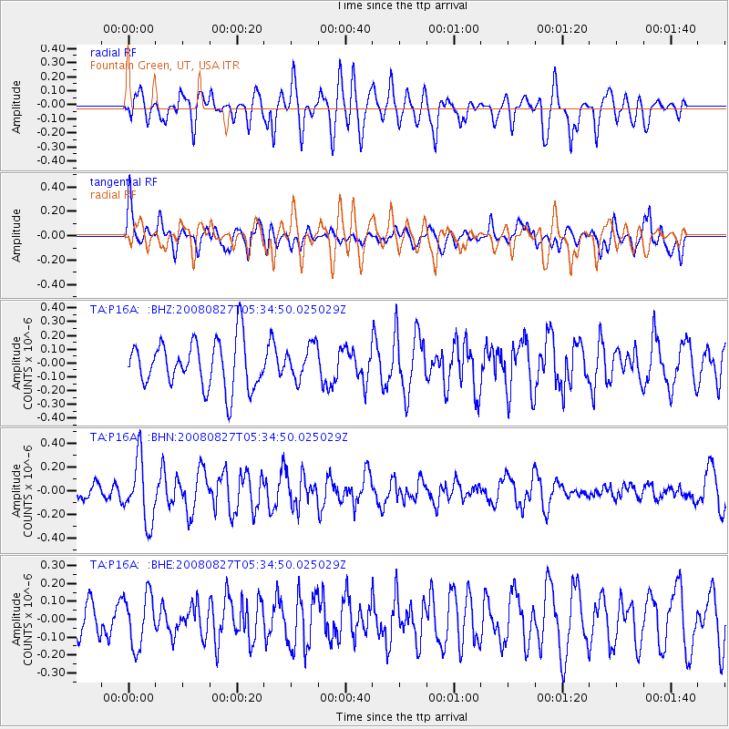
Signal To Noise
| Channel | StoN | STA | LTA |
| TA:P16A: :BHN:20080827T05:34:50.025029Z | 3.064699 | 2.6663747E-7 | 8.7002825E-8 |
| TA:P16A: :BHE:20080827T05:34:50.025029Z | 1.8195184 | 1.4608065E-7 | 8.028534E-8 |
| TA:P16A: :BHZ:20080827T05:34:50.025029Z | 0.72269505 | 1.2402934E-7 | 1.7162057E-7 |
| Arrivals |
| Ps | |
| PpPs | |
| PsPs/PpSs | |


