You are here: Home > Network List > TA - USArray Transportable Network (new EarthScope stations) Stations List
> Station P16A Fountain Green, UT, USA > Earthquake Result Viewer
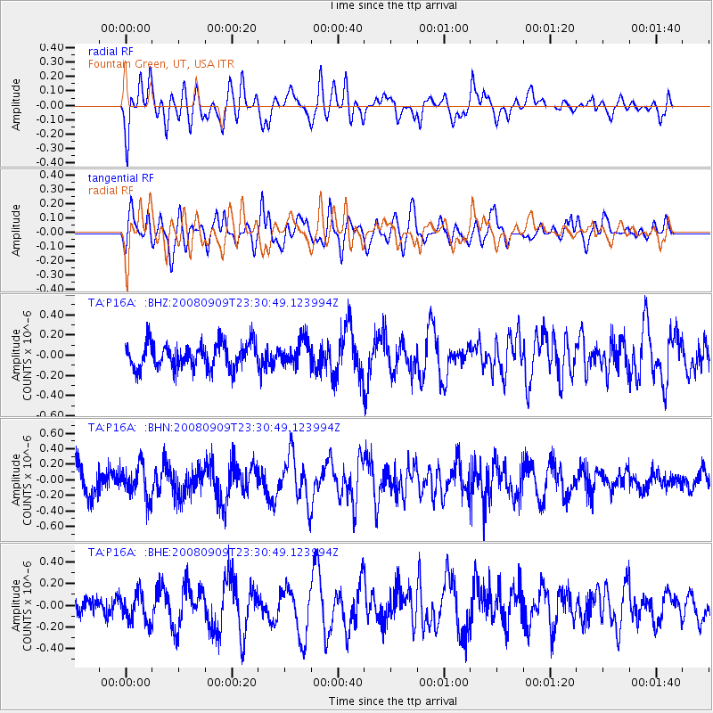
P16A Fountain Green, UT, USA - Earthquake Result Viewer
*The percent match for this event was below the threshold and hence no stack was calculated.
| Earthquake location: |
Santa Cruz Islands |
| Earthquake latitude/longitude: |
-11.8/166.5 |
| Earthquake time(UTC): |
2008/09/09 (253) 23:18:26 GMT |
| Earthquake Depth: |
99 km |
| Earthquake Magnitude: |
5.6 MW, 5.4 MB, 5.6 MW |
| Earthquake Catalog/Contributor: |
WHDF/NEIC |
|
| Network: |
TA USArray Transportable Network (new EarthScope stations) |
| Station: |
P16A Fountain Green, UT, USA |
| Lat/Lon: |
39.61 N/111.66 W |
| Elevation: |
1822 m |
|
| Distance: |
91.2 deg |
| Az: |
49.894 deg |
| Baz: |
255.797 deg |
| Ray Param: |
$rayparam |
*The percent match for this event was below the threshold and hence was not used in the summary stack. |
|
| Radial Match: |
64.10579 % |
| Radial Bump: |
400 |
| Transverse Match: |
57.57932 % |
| Transverse Bump: |
400 |
| SOD ConfigId: |
2560 |
| Insert Time: |
2010-03-06 21:24:30.241 +0000 |
| GWidth: |
2.5 |
| Max Bumps: |
400 |
| Tol: |
0.001 |
|
Signal To Noise
| Channel | StoN | STA | LTA |
| TA:P16A: :BHN:20080909T23:30:49.123994Z | 1.1589704 | 2.0667652E-7 | 1.7832771E-7 |
| TA:P16A: :BHE:20080909T23:30:49.123994Z | 1.0822312 | 1.3188998E-7 | 1.2186858E-7 |
| TA:P16A: :BHZ:20080909T23:30:49.123994Z | 0.9932584 | 1.229449E-7 | 1.2377937E-7 |
| Arrivals |
| Ps | |
| PpPs | |
| PsPs/PpSs | |


