You are here: Home > Network List > TA - USArray Transportable Network (new EarthScope stations) Stations List
> Station E18K Tukpahlearik Creek, AK, USA > Earthquake Result Viewer
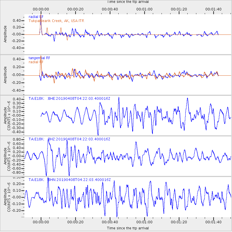
E18K Tukpahlearik Creek, AK, USA - Earthquake Result Viewer
*The percent match for this event was below the threshold and hence no stack was calculated.
| Earthquake location: |
Ryukyu Islands, Japan |
| Earthquake latitude/longitude: |
26.3/129.6 |
| Earthquake time(UTC): |
2019/04/08 (098) 04:12:40 GMT |
| Earthquake Depth: |
10 km |
| Earthquake Magnitude: |
5.5 Mww |
| Earthquake Catalog/Contributor: |
NEIC PDE/us |
|
| Network: |
TA USArray Transportable Network (new EarthScope stations) |
| Station: |
E18K Tukpahlearik Creek, AK, USA |
| Lat/Lon: |
67.42 N/160.60 W |
| Elevation: |
297 m |
|
| Distance: |
58.2 deg |
| Az: |
25.233 deg |
| Baz: |
262.2 deg |
| Ray Param: |
$rayparam |
*The percent match for this event was below the threshold and hence was not used in the summary stack. |
|
| Radial Match: |
74.28323 % |
| Radial Bump: |
389 |
| Transverse Match: |
62.612617 % |
| Transverse Bump: |
400 |
| SOD ConfigId: |
13570011 |
| Insert Time: |
2019-05-02 21:58:34.929 +0000 |
| GWidth: |
2.5 |
| Max Bumps: |
400 |
| Tol: |
0.001 |
|
Signal To Noise
| Channel | StoN | STA | LTA |
| TA:E18K: :BHZ:20190408T04:22:03.400016Z | 4.253721 | 4.6243863E-7 | 1.087139E-7 |
| TA:E18K: :BHN:20190408T04:22:03.400016Z | 1.2240984 | 1.08639725E-7 | 8.87508E-8 |
| TA:E18K: :BHE:20190408T04:22:03.400016Z | 2.248126 | 2.1774062E-7 | 9.685427E-8 |
| Arrivals |
| Ps | |
| PpPs | |
| PsPs/PpSs | |


