You are here: Home > Network List > TA - USArray Transportable Network (new EarthScope stations) Stations List
> Station O17K Koliganek, Bristol Bay, AK, USA > Earthquake Result Viewer
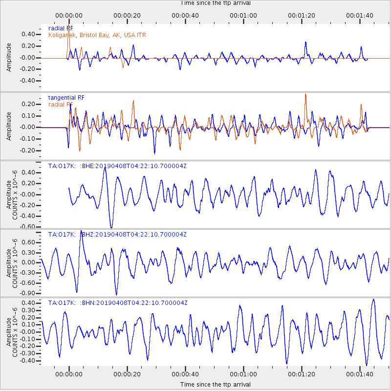
O17K Koliganek, Bristol Bay, AK, USA - Earthquake Result Viewer
*The percent match for this event was below the threshold and hence no stack was calculated.
| Earthquake location: |
Ryukyu Islands, Japan |
| Earthquake latitude/longitude: |
26.3/129.6 |
| Earthquake time(UTC): |
2019/04/08 (098) 04:12:40 GMT |
| Earthquake Depth: |
10 km |
| Earthquake Magnitude: |
5.5 Mww |
| Earthquake Catalog/Contributor: |
NEIC PDE/us |
|
| Network: |
TA USArray Transportable Network (new EarthScope stations) |
| Station: |
O17K Koliganek, Bristol Bay, AK, USA |
| Lat/Lon: |
59.77 N/157.09 W |
| Elevation: |
156 m |
|
| Distance: |
59.3 deg |
| Az: |
34.317 deg |
| Baz: |
270.065 deg |
| Ray Param: |
$rayparam |
*The percent match for this event was below the threshold and hence was not used in the summary stack. |
|
| Radial Match: |
55.621532 % |
| Radial Bump: |
327 |
| Transverse Match: |
72.71643 % |
| Transverse Bump: |
400 |
| SOD ConfigId: |
13570011 |
| Insert Time: |
2019-05-02 21:59:23.308 +0000 |
| GWidth: |
2.5 |
| Max Bumps: |
400 |
| Tol: |
0.001 |
|
Signal To Noise
| Channel | StoN | STA | LTA |
| TA:O17K: :BHZ:20190408T04:22:10.700004Z | 2.555303 | 5.017933E-7 | 1.9637329E-7 |
| TA:O17K: :BHN:20190408T04:22:10.700004Z | 1.3183397 | 1.26524E-7 | 9.597222E-8 |
| TA:O17K: :BHE:20190408T04:22:10.700004Z | 0.8097942 | 1.6828504E-7 | 2.0781212E-7 |
| Arrivals |
| Ps | |
| PpPs | |
| PsPs/PpSs | |


