You are here: Home > Network List > TA - USArray Transportable Network (new EarthScope stations) Stations List
> Station D20A Manuel Ranch, Winnett, MT, USA > Earthquake Result Viewer
D20A Manuel Ranch, Winnett, MT, USA - Earthquake Result Viewer

| Earthquake location: |
Santa Cruz Islands |
| Earthquake latitude/longitude: |
-12.4/166.1 |
| Earthquake time(UTC): |
2009/10/07 (280) 22:50:15 GMT |
| Earthquake Depth: |
21 km |
| Earthquake Magnitude: |
5.8 MB |
| Earthquake Catalog/Contributor: |
WHDF/NEIC |
|
| Network: |
TA USArray Transportable Network (new EarthScope stations) |
| Station: |
D20A Manuel Ranch, Winnett, MT, USA |
| Lat/Lon: |
47.09 N/108.14 W |
| Elevation: |
902 m |
|
| Distance: |
96.1 deg |
| Az: |
43.261 deg |
| Baz: |
258.502 deg |
| Ray Param: |
0.040596236 |
| Estimated Moho Depth: |
11.0 km |
| Estimated Crust Vp/Vs: |
1.62 |
| Assumed Crust Vp: |
6.518 km/s |
| Estimated Crust Vs: |
4.018 km/s |
| Estimated Crust Poisson's Ratio: |
0.19 |
|
| Radial Match: |
84.27984 % |
| Radial Bump: |
400 |
| Transverse Match: |
56.207985 % |
| Transverse Bump: |
302 |
| SOD ConfigId: |
2622 |
| Insert Time: |
2010-03-06 21:25:32.541 +0000 |
| GWidth: |
2.5 |
| Max Bumps: |
400 |
| Tol: |
0.001 |
|
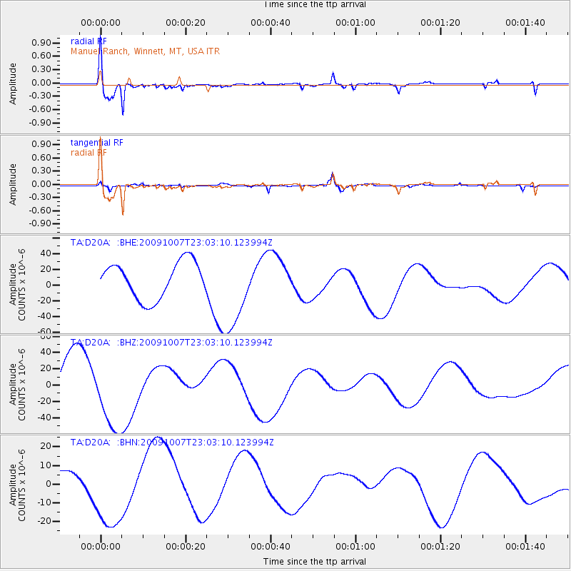
Signal To Noise
| Channel | StoN | STA | LTA |
| TA:D20A: :BHZ:20091007T23:03:10.123994Z | 1.9411844 | 4.6727477E-5 | 2.4071633E-5 |
| TA:D20A: :BHN:20091007T23:03:10.123994Z | 2.3371892 | 2.33981E-5 | 1.0011214E-5 |
| TA:D20A: :BHE:20091007T23:03:10.123994Z | 2.246112 | 5.1367053E-5 | 2.2869319E-5 |
| Arrivals |
| Ps | 1.1 SECOND |
| PpPs | 4.3 SECOND |
| PsPs/PpSs | 5.4 SECOND |


