You are here: Home > Network List > PF - Volcanologic Network of Piton de Fournaise-OVPF Stations List
> Station GPS Grandes Pentes Sud > Earthquake Result Viewer
GPS Grandes Pentes Sud - Earthquake Result Viewer
*The percent match for this event was below the threshold and hence no stack was calculated.
| Earthquake location: |
Java Sea |
| Earthquake latitude/longitude: |
-4.9/108.2 |
| Earthquake time(UTC): |
2016/10/19 (293) 00:26:01 GMT |
| Earthquake Depth: |
614 km |
| Earthquake Magnitude: |
6.6 MWW, 6.6 MWC, 6.7 MWB |
| Earthquake Catalog/Contributor: |
NEIC PDE/NEIC COMCAT |
|
| Network: |
PF Volcanologic Network of Piton de Fournaise-OVPF |
| Station: |
GPS Grandes Pentes Sud |
| Lat/Lon: |
21.27 S/55.76 E |
| Elevation: |
1004 m |
|
| Distance: |
53.3 deg |
| Az: |
247.149 deg |
| Baz: |
79.895 deg |
| Ray Param: |
$rayparam |
*The percent match for this event was below the threshold and hence was not used in the summary stack. |
|
| Radial Match: |
70.57739 % |
| Radial Bump: |
394 |
| Transverse Match: |
59.326214 % |
| Transverse Bump: |
400 |
| SOD ConfigId: |
1815711 |
| Insert Time: |
2016-11-02 00:28:40.545 +0000 |
| GWidth: |
2.5 |
| Max Bumps: |
400 |
| Tol: |
0.001 |
|
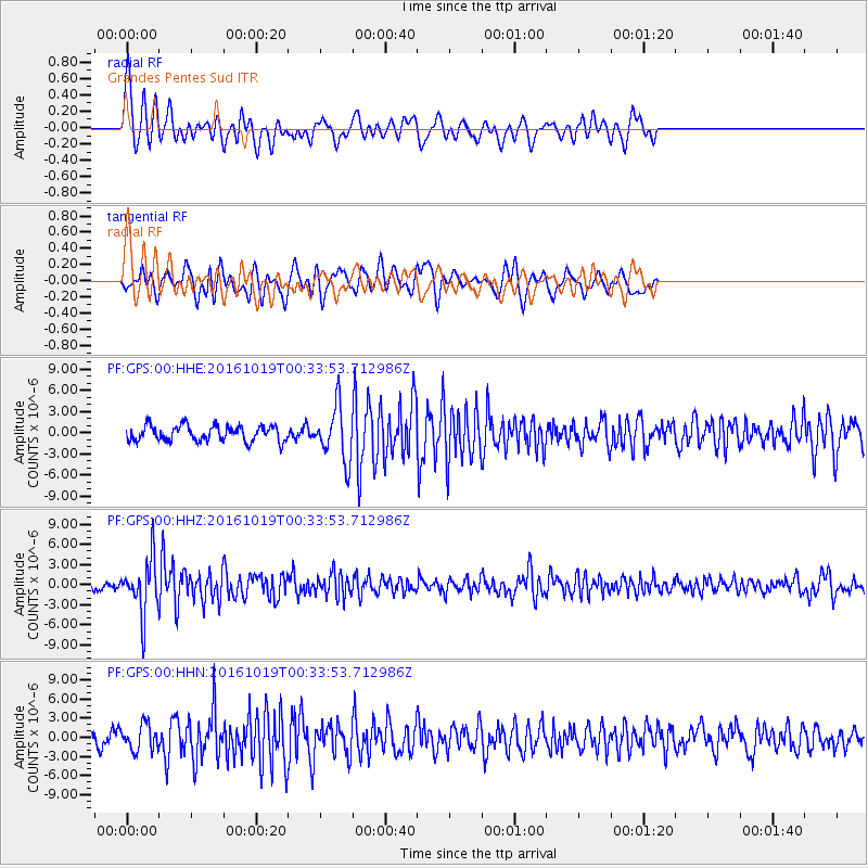
Signal To Noise
| Channel | StoN | STA | LTA |
| PF:GPS:00:HHZ:20161019T00:33:53.712986Z | 6.0062447 | 3.9975735E-6 | 6.6556953E-7 |
| PF:GPS:00:HHN:20161019T00:33:53.712986Z | 1.7640913 | 2.0154189E-6 | 1.1424686E-6 |
| PF:GPS:00:HHE:20161019T00:33:53.712986Z | 3.5043821 | 3.823837E-6 | 1.0911585E-6 |
| Arrivals |
| Ps | |
| PpPs | |
| PsPs/PpSs | |


