You are here: Home > Network List > TS - TERRAscope (Southern California Seismic Network) Stations List
> Station DGR Domenigoni Valley Reservior, California, USA > Earthquake Result Viewer
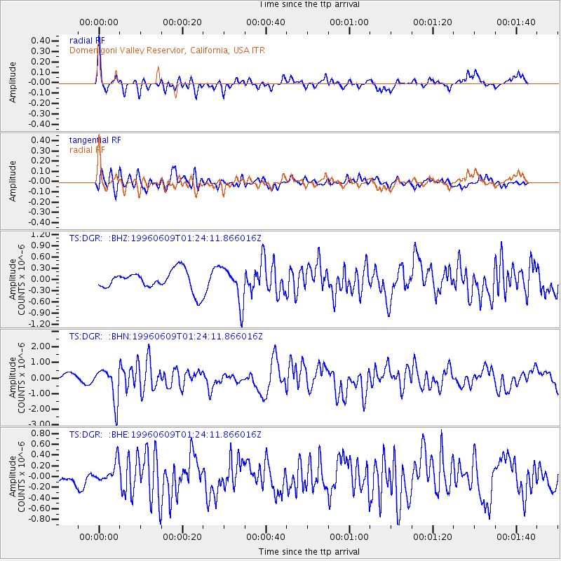
DGR Domenigoni Valley Reservior, California, USA - Earthquake Result Viewer
*The percent match for this event was below the threshold and hence no stack was calculated.
| Earthquake location: |
Mariana Islands |
| Earthquake latitude/longitude: |
17.4/145.5 |
| Earthquake time(UTC): |
1996/06/09 (161) 01:12:16 GMT |
| Earthquake Depth: |
149 km |
| Earthquake Magnitude: |
6.0 MB, 5.9 MS, 6.5 UNKNOWN, 6.5 MW |
| Earthquake Catalog/Contributor: |
WHDF/NEIC |
|
| Network: |
TS TERRAscope (Southern California Seismic Network) |
| Station: |
DGR Domenigoni Valley Reservior, California, USA |
| Lat/Lon: |
33.65 N/117.01 W |
| Elevation: |
700 m |
|
| Distance: |
86.6 deg |
| Az: |
55.939 deg |
| Baz: |
288.55 deg |
| Ray Param: |
$rayparam |
*The percent match for this event was below the threshold and hence was not used in the summary stack. |
|
| Radial Match: |
69.734856 % |
| Radial Bump: |
400 |
| Transverse Match: |
64.90509 % |
| Transverse Bump: |
400 |
| SOD ConfigId: |
4480 |
| Insert Time: |
2010-02-26 14:10:24.817 +0000 |
| GWidth: |
2.5 |
| Max Bumps: |
400 |
| Tol: |
0.001 |
|
Signal To Noise
| Channel | StoN | STA | LTA |
| TS:DGR: :BHN:19960609T01:24:11.866016Z | 5.620634 | 1.107058E-6 | 1.9696317E-7 |
| TS:DGR: :BHE:19960609T01:24:11.866016Z | 0.8474758 | 1.8900374E-7 | 2.2301963E-7 |
| TS:DGR: :BHZ:19960609T01:24:11.866016Z | 1.8977675 | 4.9518064E-7 | 2.6092798E-7 |
| Arrivals |
| Ps | |
| PpPs | |
| PsPs/PpSs | |


