You are here: Home > Network List > TA - USArray Transportable Network (new EarthScope stations) Stations List
> Station D20A Manuel Ranch, Winnett, MT, USA > Earthquake Result Viewer
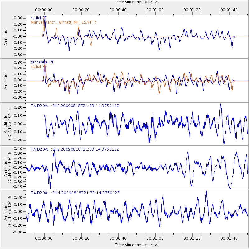
D20A Manuel Ranch, Winnett, MT, USA - Earthquake Result Viewer
*The percent match for this event was below the threshold and hence no stack was calculated.
| Earthquake location: |
South Of Fiji Islands |
| Earthquake latitude/longitude: |
-26.1/-178.4 |
| Earthquake time(UTC): |
2009/08/18 (230) 21:20:47 GMT |
| Earthquake Depth: |
270 km |
| Earthquake Magnitude: |
5.5 MB, 6.3 MW, 6.3 MW |
| Earthquake Catalog/Contributor: |
WHDF/NEIC |
|
| Network: |
TA USArray Transportable Network (new EarthScope stations) |
| Station: |
D20A Manuel Ranch, Winnett, MT, USA |
| Lat/Lon: |
47.09 N/108.14 W |
| Elevation: |
902 m |
|
| Distance: |
96.4 deg |
| Az: |
40.326 deg |
| Baz: |
238.417 deg |
| Ray Param: |
$rayparam |
*The percent match for this event was below the threshold and hence was not used in the summary stack. |
|
| Radial Match: |
51.829197 % |
| Radial Bump: |
400 |
| Transverse Match: |
49.299583 % |
| Transverse Bump: |
400 |
| SOD ConfigId: |
2622 |
| Insert Time: |
2010-03-06 21:26:42.900 +0000 |
| GWidth: |
2.5 |
| Max Bumps: |
400 |
| Tol: |
0.001 |
|
Signal To Noise
| Channel | StoN | STA | LTA |
| TA:D20A: :BHZ:20090818T21:33:14.375012Z | 3.1849158 | 1.7155342E-7 | 5.3864355E-8 |
| TA:D20A: :BHN:20090818T21:33:14.375012Z | 1.060387 | 9.030434E-8 | 8.516167E-8 |
| TA:D20A: :BHE:20090818T21:33:14.375012Z | 0.57592547 | 4.58599E-8 | 7.962819E-8 |
| Arrivals |
| Ps | |
| PpPs | |
| PsPs/PpSs | |


