You are here: Home > Network List > TA - USArray Transportable Network (new EarthScope stations) Stations List
> Station D20A Manuel Ranch, Winnett, MT, USA > Earthquake Result Viewer
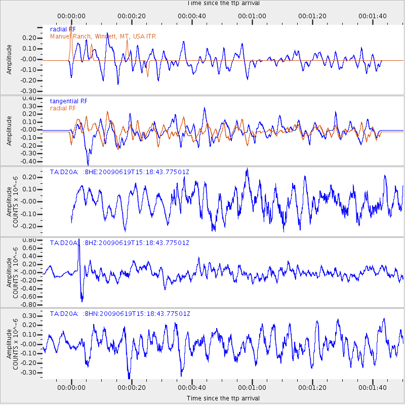
D20A Manuel Ranch, Winnett, MT, USA - Earthquake Result Viewer
*The percent match for this event was below the threshold and hence no stack was calculated.
| Earthquake location: |
Mariana Islands |
| Earthquake latitude/longitude: |
14.1/145.2 |
| Earthquake time(UTC): |
2009/06/19 (170) 15:06:24 GMT |
| Earthquake Depth: |
114 km |
| Earthquake Magnitude: |
5.5 MB, 5.5 MW |
| Earthquake Catalog/Contributor: |
WHDF/NEIC |
|
| Network: |
TA USArray Transportable Network (new EarthScope stations) |
| Station: |
D20A Manuel Ranch, Winnett, MT, USA |
| Lat/Lon: |
47.09 N/108.14 W |
| Elevation: |
902 m |
|
| Distance: |
90.8 deg |
| Az: |
40.891 deg |
| Baz: |
291.62 deg |
| Ray Param: |
$rayparam |
*The percent match for this event was below the threshold and hence was not used in the summary stack. |
|
| Radial Match: |
65.68641 % |
| Radial Bump: |
400 |
| Transverse Match: |
71.13746 % |
| Transverse Bump: |
400 |
| SOD ConfigId: |
2648 |
| Insert Time: |
2010-03-06 21:27:12.772 +0000 |
| GWidth: |
2.5 |
| Max Bumps: |
400 |
| Tol: |
0.001 |
|
Signal To Noise
| Channel | StoN | STA | LTA |
| TA:D20A: :BHZ:20090619T15:18:43.77501Z | 4.4206347 | 3.2649237E-7 | 7.385645E-8 |
| TA:D20A: :BHN:20090619T15:18:43.77501Z | 0.71206886 | 5.1148987E-8 | 7.1831515E-8 |
| TA:D20A: :BHE:20090619T15:18:43.77501Z | 0.9494117 | 8.503994E-8 | 8.95712E-8 |
| Arrivals |
| Ps | |
| PpPs | |
| PsPs/PpSs | |


