You are here: Home > Network List > TA - USArray Transportable Network (new EarthScope stations) Stations List
> Station F20K Avaraart Lake, AK, USA > Earthquake Result Viewer
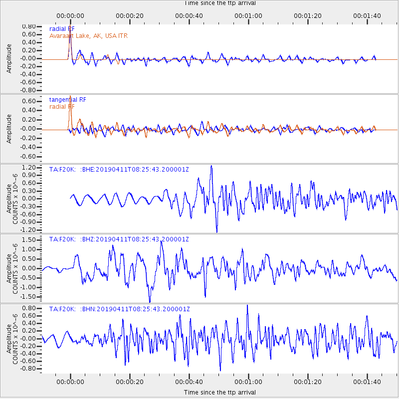
F20K Avaraart Lake, AK, USA - Earthquake Result Viewer
*The percent match for this event was below the threshold and hence no stack was calculated.
| Earthquake location: |
Off East Coast Of Honshu, Japan |
| Earthquake latitude/longitude: |
40.4/143.3 |
| Earthquake time(UTC): |
2019/04/11 (101) 08:18:20 GMT |
| Earthquake Depth: |
12 km |
| Earthquake Magnitude: |
6.1 Mww |
| Earthquake Catalog/Contributor: |
NEIC PDE/us |
|
| Network: |
TA USArray Transportable Network (new EarthScope stations) |
| Station: |
F20K Avaraart Lake, AK, USA |
| Lat/Lon: |
67.05 N/155.73 W |
| Elevation: |
136 m |
|
| Distance: |
42.3 deg |
| Az: |
30.618 deg |
| Baz: |
262.531 deg |
| Ray Param: |
$rayparam |
*The percent match for this event was below the threshold and hence was not used in the summary stack. |
|
| Radial Match: |
78.301704 % |
| Radial Bump: |
400 |
| Transverse Match: |
67.7227 % |
| Transverse Bump: |
400 |
| SOD ConfigId: |
13570011 |
| Insert Time: |
2019-05-02 22:11:39.912 +0000 |
| GWidth: |
2.5 |
| Max Bumps: |
400 |
| Tol: |
0.001 |
|
Signal To Noise
| Channel | StoN | STA | LTA |
| TA:F20K: :BHZ:20190411T08:25:43.200001Z | 4.124146 | 4.3891308E-7 | 1.06425205E-7 |
| TA:F20K: :BHN:20190411T08:25:43.200001Z | 0.8677929 | 8.5059604E-8 | 9.8018326E-8 |
| TA:F20K: :BHE:20190411T08:25:43.200001Z | 1.4083027 | 2.0391887E-7 | 1.4479762E-7 |
| Arrivals |
| Ps | |
| PpPs | |
| PsPs/PpSs | |


