You are here: Home > Network List > TA - USArray Transportable Network (new EarthScope stations) Stations List
> Station I23K Minto, Yukon-Koyukuk, AK, USA > Earthquake Result Viewer
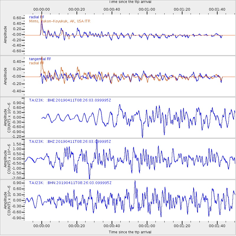
I23K Minto, Yukon-Koyukuk, AK, USA - Earthquake Result Viewer
*The percent match for this event was below the threshold and hence no stack was calculated.
| Earthquake location: |
Off East Coast Of Honshu, Japan |
| Earthquake latitude/longitude: |
40.4/143.3 |
| Earthquake time(UTC): |
2019/04/11 (101) 08:18:20 GMT |
| Earthquake Depth: |
12 km |
| Earthquake Magnitude: |
6.1 Mww |
| Earthquake Catalog/Contributor: |
NEIC PDE/us |
|
| Network: |
TA USArray Transportable Network (new EarthScope stations) |
| Station: |
I23K Minto, Yukon-Koyukuk, AK, USA |
| Lat/Lon: |
65.15 N/149.36 W |
| Elevation: |
149 m |
|
| Distance: |
44.8 deg |
| Az: |
33.608 deg |
| Baz: |
270.513 deg |
| Ray Param: |
$rayparam |
*The percent match for this event was below the threshold and hence was not used in the summary stack. |
|
| Radial Match: |
79.9889 % |
| Radial Bump: |
400 |
| Transverse Match: |
75.11391 % |
| Transverse Bump: |
400 |
| SOD ConfigId: |
13570011 |
| Insert Time: |
2019-05-02 22:12:03.956 +0000 |
| GWidth: |
2.5 |
| Max Bumps: |
400 |
| Tol: |
0.001 |
|
Signal To Noise
| Channel | StoN | STA | LTA |
| TA:I23K: :BHZ:20190411T08:26:03.099995Z | 2.2679243 | 2.7455758E-7 | 1.2106118E-7 |
| TA:I23K: :BHN:20190411T08:26:03.099995Z | 0.7928079 | 1.1420294E-7 | 1.4404868E-7 |
| TA:I23K: :BHE:20190411T08:26:03.099995Z | 2.2840924 | 3.3838165E-7 | 1.481471E-7 |
| Arrivals |
| Ps | |
| PpPs | |
| PsPs/PpSs | |


