You are here: Home > Network List > TS - TERRAscope (Southern California Seismic Network) Stations List
> Station DGR Domenigoni Valley Reservior, California, USA > Earthquake Result Viewer
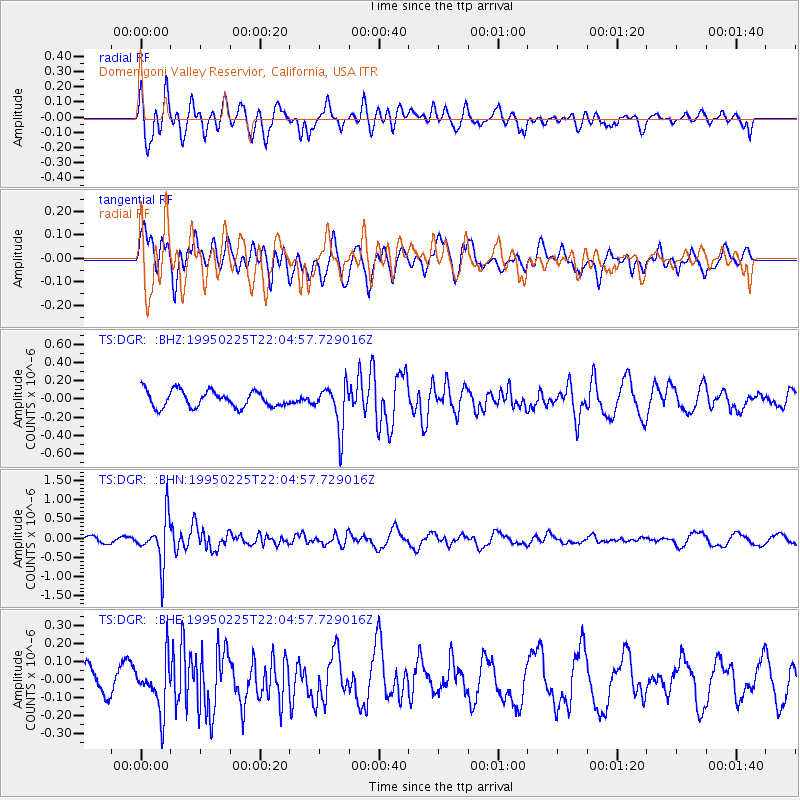
DGR Domenigoni Valley Reservior, California, USA - Earthquake Result Viewer
*The percent match for this event was below the threshold and hence no stack was calculated.
| Earthquake location: |
Fiji Islands Region |
| Earthquake latitude/longitude: |
-18.2/-178.1 |
| Earthquake time(UTC): |
1995/02/25 (056) 21:54:29 GMT |
| Earthquake Depth: |
568 km |
| Earthquake Magnitude: |
5.6 MB, 5.7 UNKNOWN |
| Earthquake Catalog/Contributor: |
WHDF/NEIC |
|
| Network: |
TS TERRAscope (Southern California Seismic Network) |
| Station: |
DGR Domenigoni Valley Reservior, California, USA |
| Lat/Lon: |
33.65 N/117.01 W |
| Elevation: |
700 m |
|
| Distance: |
77.8 deg |
| Az: |
48.339 deg |
| Baz: |
238.344 deg |
| Ray Param: |
$rayparam |
*The percent match for this event was below the threshold and hence was not used in the summary stack. |
|
| Radial Match: |
60.22861 % |
| Radial Bump: |
400 |
| Transverse Match: |
59.90417 % |
| Transverse Bump: |
400 |
| SOD ConfigId: |
4480 |
| Insert Time: |
2010-02-26 14:10:30.029 +0000 |
| GWidth: |
2.5 |
| Max Bumps: |
400 |
| Tol: |
0.001 |
|
Signal To Noise
| Channel | StoN | STA | LTA |
| TS:DGR: :BHN:19950225T22:04:57.729016Z | 5.2653046 | 6.006047E-7 | 1.1406837E-7 |
| TS:DGR: :BHE:19950225T22:04:57.729016Z | 2.4716234 | 1.39918E-7 | 5.6609757E-8 |
| TS:DGR: :BHZ:19950225T22:04:57.729016Z | 2.7167645 | 2.4323947E-7 | 8.953278E-8 |
| Arrivals |
| Ps | |
| PpPs | |
| PsPs/PpSs | |


