You are here: Home > Network List > II - Global Seismograph Network (GSN - IRIS/IDA) Stations List
> Station WRAB Tennant Creek, NT, Australia > Earthquake Result Viewer
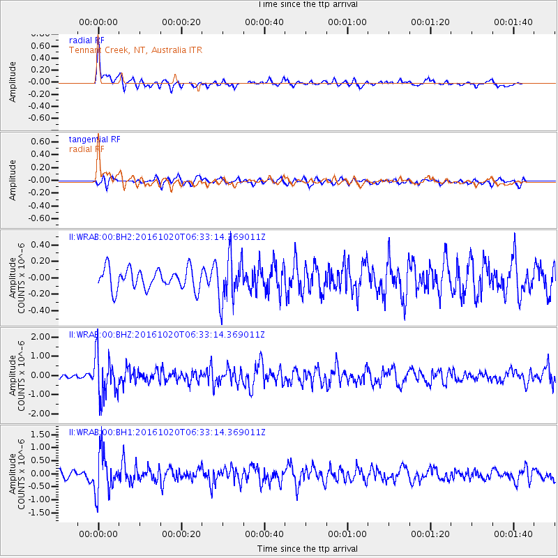
WRAB Tennant Creek, NT, Australia - Earthquake Result Viewer
*The percent match for this event was below the threshold and hence no stack was calculated.
| Earthquake location: |
Volcano Islands, Japan Region |
| Earthquake latitude/longitude: |
22.3/143.8 |
| Earthquake time(UTC): |
2016/10/20 (294) 06:25:56 GMT |
| Earthquake Depth: |
108 km |
| Earthquake Magnitude: |
5.7 MB |
| Earthquake Catalog/Contributor: |
NEIC PDE/NEIC COMCAT |
|
| Network: |
II Global Seismograph Network (GSN - IRIS/IDA) |
| Station: |
WRAB Tennant Creek, NT, Australia |
| Lat/Lon: |
19.93 S/134.36 E |
| Elevation: |
366 m |
|
| Distance: |
42.9 deg |
| Az: |
193.031 deg |
| Baz: |
12.826 deg |
| Ray Param: |
$rayparam |
*The percent match for this event was below the threshold and hence was not used in the summary stack. |
|
| Radial Match: |
59.406227 % |
| Radial Bump: |
384 |
| Transverse Match: |
51.27349 % |
| Transverse Bump: |
400 |
| SOD ConfigId: |
1815711 |
| Insert Time: |
2016-11-03 06:27:33.791 +0000 |
| GWidth: |
2.5 |
| Max Bumps: |
400 |
| Tol: |
0.001 |
|
Signal To Noise
| Channel | StoN | STA | LTA |
| II:WRAB:00:BHZ:20161020T06:33:14.369011Z | 7.380415 | 1.1105426E-6 | 1.5047156E-7 |
| II:WRAB:00:BH1:20161020T06:33:14.369011Z | 6.1852994 | 7.7727276E-7 | 1.2566453E-7 |
| II:WRAB:00:BH2:20161020T06:33:14.369011Z | 2.3318965 | 2.9157383E-7 | 1.2503722E-7 |
| Arrivals |
| Ps | |
| PpPs | |
| PsPs/PpSs | |


