You are here: Home > Network List > TA - USArray Transportable Network (new EarthScope stations) Stations List
> Station D25K Kavik River, AK, USA > Earthquake Result Viewer
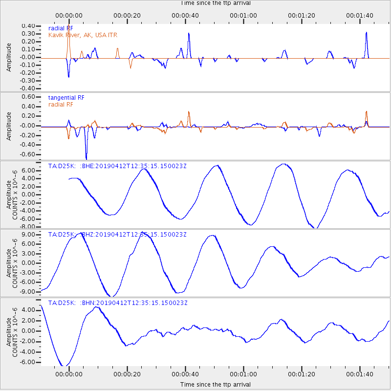
D25K Kavik River, AK, USA - Earthquake Result Viewer
*The percent match for this event was below the threshold and hence no stack was calculated.
| Earthquake location: |
Samoa Islands Region |
| Earthquake latitude/longitude: |
-15.4/-172.7 |
| Earthquake time(UTC): |
2019/04/12 (102) 12:23:03 GMT |
| Earthquake Depth: |
10 km |
| Earthquake Magnitude: |
5.8 mb |
| Earthquake Catalog/Contributor: |
NEIC PDE/us |
|
| Network: |
TA USArray Transportable Network (new EarthScope stations) |
| Station: |
D25K Kavik River, AK, USA |
| Lat/Lon: |
69.32 N/146.38 W |
| Elevation: |
770 m |
|
| Distance: |
86.5 deg |
| Az: |
9.084 deg |
| Baz: |
205.389 deg |
| Ray Param: |
$rayparam |
*The percent match for this event was below the threshold and hence was not used in the summary stack. |
|
| Radial Match: |
74.86741 % |
| Radial Bump: |
376 |
| Transverse Match: |
96.31263 % |
| Transverse Bump: |
396 |
| SOD ConfigId: |
13570011 |
| Insert Time: |
2019-05-02 22:32:07.913 +0000 |
| GWidth: |
2.5 |
| Max Bumps: |
400 |
| Tol: |
0.001 |
|
Signal To Noise
| Channel | StoN | STA | LTA |
| TA:D25K: :BHZ:20190412T12:35:15.150023Z | 1.8223261 | 9.431577E-6 | 5.175571E-6 |
| TA:D25K: :BHN:20190412T12:35:15.150023Z | 1.5648735 | 4.796145E-6 | 3.0648769E-6 |
| TA:D25K: :BHE:20190412T12:35:15.150023Z | 0.7672872 | 2.720251E-6 | 3.5452836E-6 |
| Arrivals |
| Ps | |
| PpPs | |
| PsPs/PpSs | |


