You are here: Home > Network List > TA - USArray Transportable Network (new EarthScope stations) Stations List
> Station F20K Avaraart Lake, AK, USA > Earthquake Result Viewer
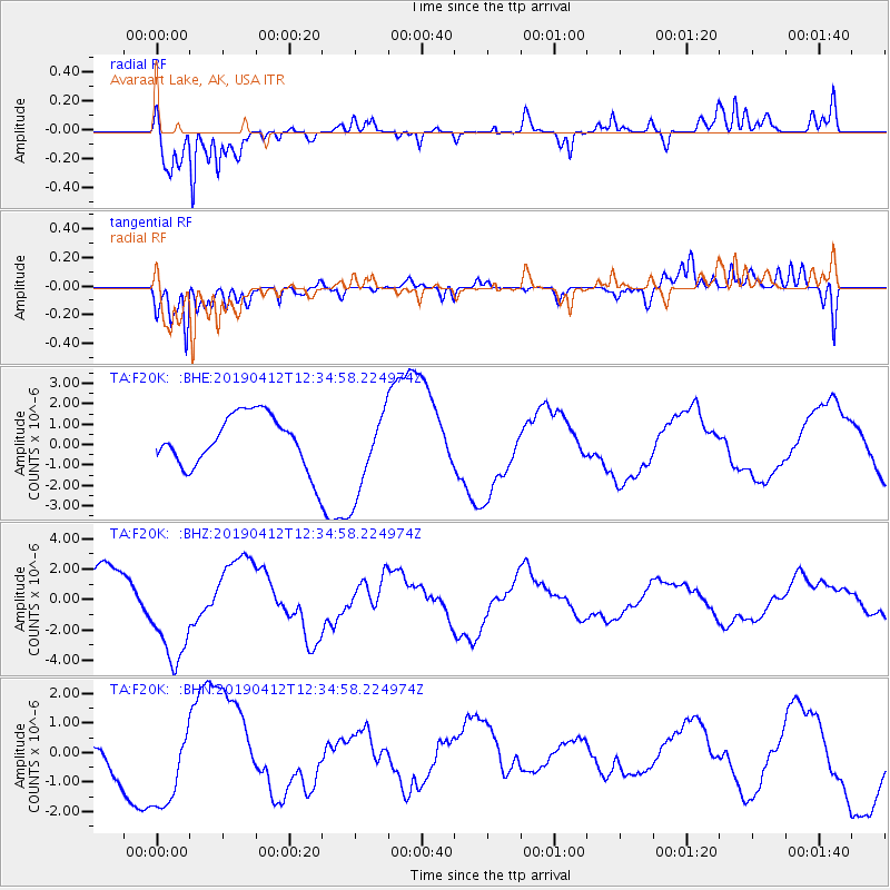
F20K Avaraart Lake, AK, USA - Earthquake Result Viewer
*The percent match for this event was below the threshold and hence no stack was calculated.
| Earthquake location: |
Samoa Islands Region |
| Earthquake latitude/longitude: |
-15.4/-172.7 |
| Earthquake time(UTC): |
2019/04/12 (102) 12:23:03 GMT |
| Earthquake Depth: |
10 km |
| Earthquake Magnitude: |
5.8 mb |
| Earthquake Catalog/Contributor: |
NEIC PDE/us |
|
| Network: |
TA USArray Transportable Network (new EarthScope stations) |
| Station: |
F20K Avaraart Lake, AK, USA |
| Lat/Lon: |
67.05 N/155.73 W |
| Elevation: |
136 m |
|
| Distance: |
83.2 deg |
| Az: |
6.628 deg |
| Baz: |
196.491 deg |
| Ray Param: |
$rayparam |
*The percent match for this event was below the threshold and hence was not used in the summary stack. |
|
| Radial Match: |
87.09843 % |
| Radial Bump: |
400 |
| Transverse Match: |
91.133095 % |
| Transverse Bump: |
400 |
| SOD ConfigId: |
13570011 |
| Insert Time: |
2019-05-02 22:32:12.248 +0000 |
| GWidth: |
2.5 |
| Max Bumps: |
400 |
| Tol: |
0.001 |
|
Signal To Noise
| Channel | StoN | STA | LTA |
| TA:F20K: :BHZ:20190412T12:34:58.224974Z | 2.6233952 | 3.3943818E-6 | 1.2938888E-6 |
| TA:F20K: :BHN:20190412T12:34:58.224974Z | 2.133913 | 1.5415472E-6 | 7.224039E-7 |
| TA:F20K: :BHE:20190412T12:34:58.224974Z | 1.665349 | 2.1090646E-6 | 1.26644E-6 |
| Arrivals |
| Ps | |
| PpPs | |
| PsPs/PpSs | |


