You are here: Home > Network List > TA - USArray Transportable Network (new EarthScope stations) Stations List
> Station H16K Elim, AK, USA > Earthquake Result Viewer
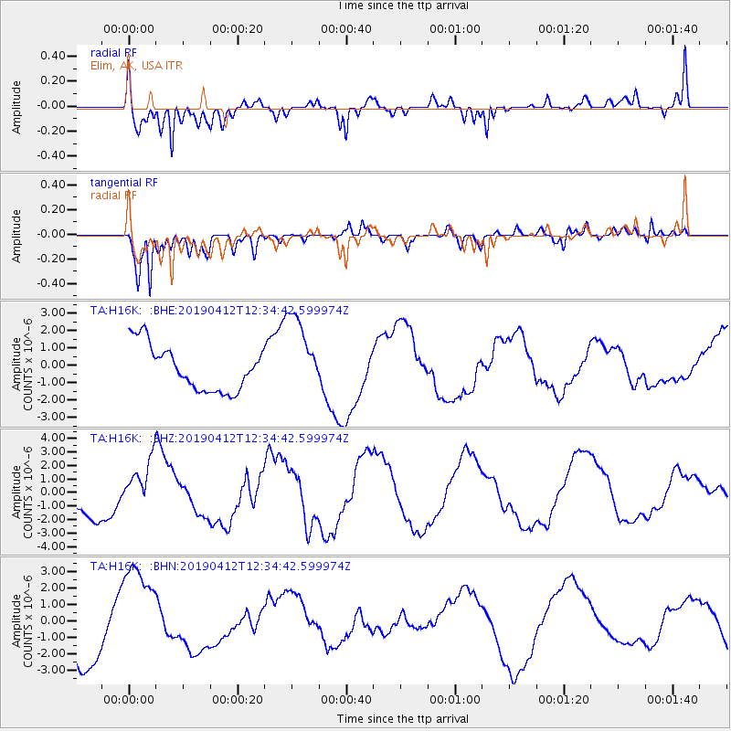
H16K Elim, AK, USA - Earthquake Result Viewer
*The percent match for this event was below the threshold and hence no stack was calculated.
| Earthquake location: |
Samoa Islands Region |
| Earthquake latitude/longitude: |
-15.4/-172.7 |
| Earthquake time(UTC): |
2019/04/12 (102) 12:23:03 GMT |
| Earthquake Depth: |
10 km |
| Earthquake Magnitude: |
5.8 mb |
| Earthquake Catalog/Contributor: |
NEIC PDE/us |
|
| Network: |
TA USArray Transportable Network (new EarthScope stations) |
| Station: |
H16K Elim, AK, USA |
| Lat/Lon: |
64.64 N/162.24 W |
| Elevation: |
216 m |
|
| Distance: |
80.2 deg |
| Az: |
4.558 deg |
| Baz: |
190.253 deg |
| Ray Param: |
$rayparam |
*The percent match for this event was below the threshold and hence was not used in the summary stack. |
|
| Radial Match: |
75.930855 % |
| Radial Bump: |
400 |
| Transverse Match: |
79.14115 % |
| Transverse Bump: |
400 |
| SOD ConfigId: |
13570011 |
| Insert Time: |
2019-05-02 22:32:16.854 +0000 |
| GWidth: |
2.5 |
| Max Bumps: |
400 |
| Tol: |
0.001 |
|
Signal To Noise
| Channel | StoN | STA | LTA |
| TA:H16K: :BHZ:20190412T12:34:42.599974Z | 1.8253546 | 1.804341E-6 | 9.88488E-7 |
| TA:H16K: :BHN:20190412T12:34:42.599974Z | 2.3219013 | 3.0521453E-6 | 1.3145026E-6 |
| TA:H16K: :BHE:20190412T12:34:42.599974Z | 1.8061267 | 2.3314497E-6 | 1.290856E-6 |
| Arrivals |
| Ps | |
| PpPs | |
| PsPs/PpSs | |


