You are here: Home > Network List > TA - USArray Transportable Network (new EarthScope stations) Stations List
> Station 125A Gardner Draw, Artesia, NM, USA > Earthquake Result Viewer
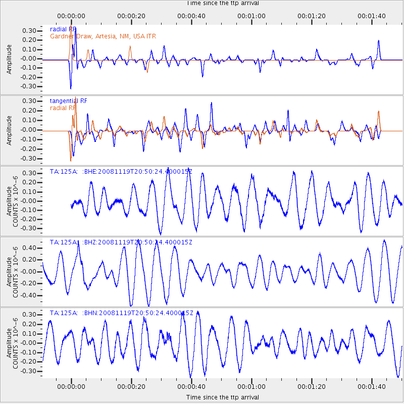
125A Gardner Draw, Artesia, NM, USA - Earthquake Result Viewer
*The percent match for this event was below the threshold and hence no stack was calculated.
| Earthquake location: |
South Of Fiji Islands |
| Earthquake latitude/longitude: |
-22.2/-179.7 |
| Earthquake time(UTC): |
2008/11/19 (324) 20:38:58 GMT |
| Earthquake Depth: |
596 km |
| Earthquake Magnitude: |
5.8 MW, 5.2 MB, 5.8 MW |
| Earthquake Catalog/Contributor: |
WHDF/NEIC |
|
| Network: |
TA USArray Transportable Network (new EarthScope stations) |
| Station: |
125A Gardner Draw, Artesia, NM, USA |
| Lat/Lon: |
32.66 N/104.66 W |
| Elevation: |
1212 m |
|
| Distance: |
90.0 deg |
| Az: |
54.59 deg |
| Baz: |
243.589 deg |
| Ray Param: |
$rayparam |
*The percent match for this event was below the threshold and hence was not used in the summary stack. |
|
| Radial Match: |
70.45109 % |
| Radial Bump: |
400 |
| Transverse Match: |
58.93466 % |
| Transverse Bump: |
400 |
| SOD ConfigId: |
2658 |
| Insert Time: |
2010-03-06 21:29:57.854 +0000 |
| GWidth: |
2.5 |
| Max Bumps: |
400 |
| Tol: |
0.001 |
|
Signal To Noise
| Channel | StoN | STA | LTA |
| TA:125A: :BHZ:20081119T20:50:24.400015Z | 1.3244312 | 2.4425685E-7 | 1.8442398E-7 |
| TA:125A: :BHN:20081119T20:50:24.400015Z | 0.7812355 | 1.2706059E-7 | 1.6264056E-7 |
| TA:125A: :BHE:20081119T20:50:24.400015Z | 2.3409626 | 2.2446714E-7 | 9.5886676E-8 |
| Arrivals |
| Ps | |
| PpPs | |
| PsPs/PpSs | |


