You are here: Home > Network List > UW - Pacific Northwest Regional Seismic Network Stations List
> Station UMAT Pilot Rock, OR, USA > Earthquake Result Viewer
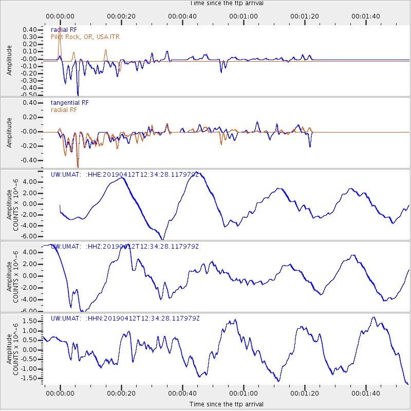
UMAT Pilot Rock, OR, USA - Earthquake Result Viewer
*The percent match for this event was below the threshold and hence no stack was calculated.
| Earthquake location: |
Samoa Islands Region |
| Earthquake latitude/longitude: |
-15.4/-172.7 |
| Earthquake time(UTC): |
2019/04/12 (102) 12:23:03 GMT |
| Earthquake Depth: |
10 km |
| Earthquake Magnitude: |
5.8 mb |
| Earthquake Catalog/Contributor: |
NEIC PDE/us |
|
| Network: |
UW Pacific Northwest Regional Seismic Network |
| Station: |
UMAT Pilot Rock, OR, USA |
| Lat/Lon: |
45.29 N/118.96 W |
| Elevation: |
1318 m |
|
| Distance: |
77.5 deg |
| Az: |
35.664 deg |
| Baz: |
232.812 deg |
| Ray Param: |
$rayparam |
*The percent match for this event was below the threshold and hence was not used in the summary stack. |
|
| Radial Match: |
91.263306 % |
| Radial Bump: |
400 |
| Transverse Match: |
94.43363 % |
| Transverse Bump: |
400 |
| SOD ConfigId: |
13570011 |
| Insert Time: |
2019-05-02 22:33:34.273 +0000 |
| GWidth: |
2.5 |
| Max Bumps: |
400 |
| Tol: |
0.001 |
|
Signal To Noise
| Channel | StoN | STA | LTA |
| UW:UMAT: :HHZ:20190412T12:34:28.117979Z | 1.1682293 | 3.0600766E-6 | 2.6194143E-6 |
| UW:UMAT: :HHN:20190412T12:34:28.117979Z | 0.34601212 | 4.1295937E-7 | 1.1934824E-6 |
| UW:UMAT: :HHE:20190412T12:34:28.117979Z | 2.0938916 | 5.751084E-6 | 2.7466006E-6 |
| Arrivals |
| Ps | |
| PpPs | |
| PsPs/PpSs | |


