You are here: Home > Network List > TS - TERRAscope (Southern California Seismic Network) Stations List
> Station DGR Domenigoni Valley Reservior, California, USA > Earthquake Result Viewer
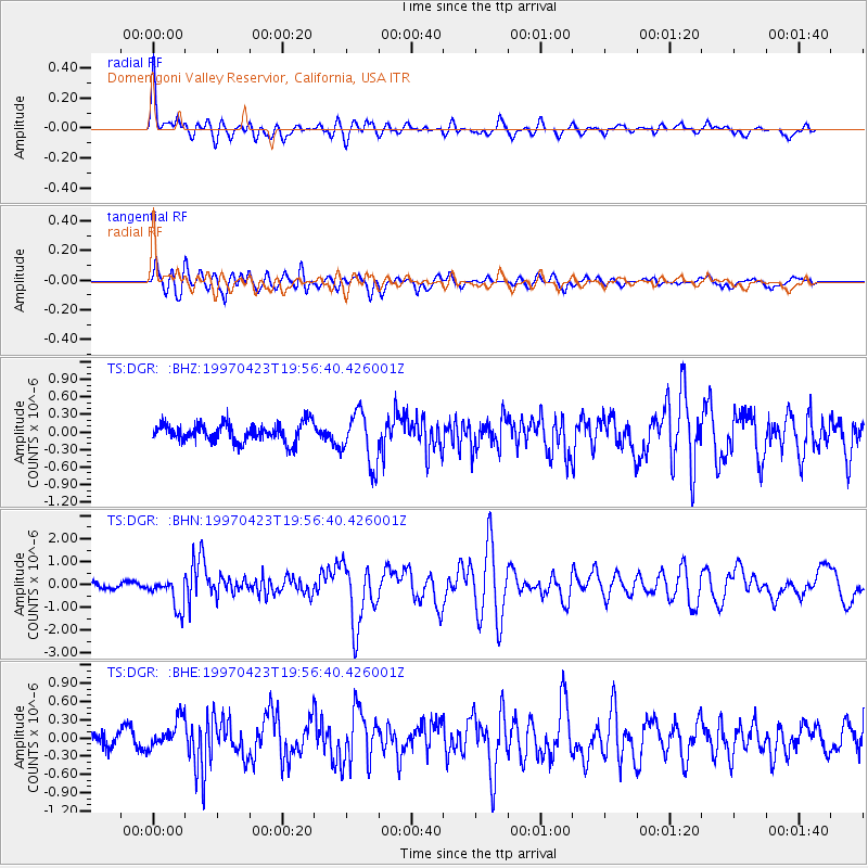
DGR Domenigoni Valley Reservior, California, USA - Earthquake Result Viewer
*The percent match for this event was below the threshold and hence no stack was calculated.
| Earthquake location: |
Mariana Islands |
| Earthquake latitude/longitude: |
14.0/144.9 |
| Earthquake time(UTC): |
1997/04/23 (113) 19:44:28 GMT |
| Earthquake Depth: |
101 km |
| Earthquake Magnitude: |
6.2 MB, 6.5 UNKNOWN, 6.5 MW |
| Earthquake Catalog/Contributor: |
WHDF/NEIC |
|
| Network: |
TS TERRAscope (Southern California Seismic Network) |
| Station: |
DGR Domenigoni Valley Reservior, California, USA |
| Lat/Lon: |
33.65 N/117.01 W |
| Elevation: |
700 m |
|
| Distance: |
88.9 deg |
| Az: |
55.689 deg |
| Baz: |
286.005 deg |
| Ray Param: |
$rayparam |
*The percent match for this event was below the threshold and hence was not used in the summary stack. |
|
| Radial Match: |
78.56658 % |
| Radial Bump: |
400 |
| Transverse Match: |
73.206955 % |
| Transverse Bump: |
400 |
| SOD ConfigId: |
4480 |
| Insert Time: |
2010-02-26 14:10:32.176 +0000 |
| GWidth: |
2.5 |
| Max Bumps: |
400 |
| Tol: |
0.001 |
|
Signal To Noise
| Channel | StoN | STA | LTA |
| TS:DGR: :BHN:19970423T19:56:40.426001Z | 3.9240541 | 7.0159206E-7 | 1.7879265E-7 |
| TS:DGR: :BHE:19970423T19:56:40.426001Z | 1.8435029 | 2.4168074E-7 | 1.3109866E-7 |
| TS:DGR: :BHZ:19970423T19:56:40.426001Z | 2.8359408 | 4.5022193E-7 | 1.5875575E-7 |
| Arrivals |
| Ps | |
| PpPs | |
| PsPs/PpSs | |


