You are here: Home > Network List > TA - USArray Transportable Network (new EarthScope stations) Stations List
> Station 125A Gardner Draw, Artesia, NM, USA > Earthquake Result Viewer
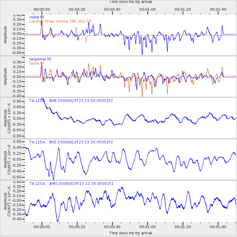
125A Gardner Draw, Artesia, NM, USA - Earthquake Result Viewer
*The percent match for this event was below the threshold and hence no stack was calculated.
| Earthquake location: |
Tonga Islands |
| Earthquake latitude/longitude: |
-15.6/-173.4 |
| Earthquake time(UTC): |
2009/09/29 (272) 23:11:51 GMT |
| Earthquake Depth: |
10 km |
| Earthquake Magnitude: |
5.5 MB |
| Earthquake Catalog/Contributor: |
WHDF/NEIC |
|
| Network: |
TA USArray Transportable Network (new EarthScope stations) |
| Station: |
125A Gardner Draw, Artesia, NM, USA |
| Lat/Lon: |
32.66 N/104.66 W |
| Elevation: |
1212 m |
|
| Distance: |
81.3 deg |
| Az: |
52.672 deg |
| Baz: |
245.278 deg |
| Ray Param: |
$rayparam |
*The percent match for this event was below the threshold and hence was not used in the summary stack. |
|
| Radial Match: |
42.15799 % |
| Radial Bump: |
276 |
| Transverse Match: |
69.92366 % |
| Transverse Bump: |
400 |
| SOD ConfigId: |
2622 |
| Insert Time: |
2010-03-06 21:30:05.337 +0000 |
| GWidth: |
2.5 |
| Max Bumps: |
400 |
| Tol: |
0.001 |
|
Signal To Noise
| Channel | StoN | STA | LTA |
| TA:125A: :BHZ:20090929T23:23:36.050015Z | 1.2898144 | 2.8344797E-7 | 2.1975873E-7 |
| TA:125A: :BHN:20090929T23:23:36.050015Z | 0.7266282 | 1.6120885E-7 | 2.2185877E-7 |
| TA:125A: :BHE:20090929T23:23:36.050015Z | 0.9155706 | 3.0604005E-7 | 3.3426156E-7 |
| Arrivals |
| Ps | |
| PpPs | |
| PsPs/PpSs | |


