You are here: Home > Network List > TA - USArray Transportable Network (new EarthScope stations) Stations List
> Station 125A Gardner Draw, Artesia, NM, USA > Earthquake Result Viewer
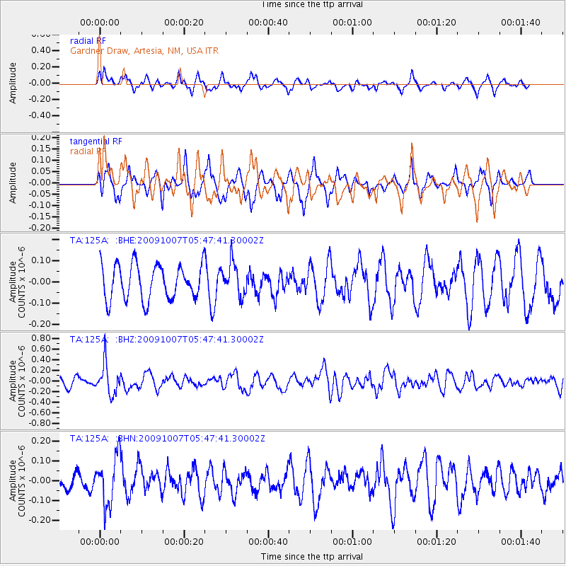
125A Gardner Draw, Artesia, NM, USA - Earthquake Result Viewer
*The percent match for this event was below the threshold and hence no stack was calculated.
| Earthquake location: |
Rat Islands, Aleutian Islands |
| Earthquake latitude/longitude: |
52.2/178.1 |
| Earthquake time(UTC): |
2009/10/07 (280) 05:38:37 GMT |
| Earthquake Depth: |
138 km |
| Earthquake Magnitude: |
5.6 MB, 5.6 MW, 5.6 MW |
| Earthquake Catalog/Contributor: |
WHDF/NEIC |
|
| Network: |
TA USArray Transportable Network (new EarthScope stations) |
| Station: |
125A Gardner Draw, Artesia, NM, USA |
| Lat/Lon: |
32.66 N/104.66 W |
| Elevation: |
1212 m |
|
| Distance: |
57.5 deg |
| Az: |
77.35 deg |
| Baz: |
314.552 deg |
| Ray Param: |
$rayparam |
*The percent match for this event was below the threshold and hence was not used in the summary stack. |
|
| Radial Match: |
67.27211 % |
| Radial Bump: |
400 |
| Transverse Match: |
50.168087 % |
| Transverse Bump: |
299 |
| SOD ConfigId: |
2622 |
| Insert Time: |
2010-03-06 21:30:07.615 +0000 |
| GWidth: |
2.5 |
| Max Bumps: |
400 |
| Tol: |
0.001 |
|
Signal To Noise
| Channel | StoN | STA | LTA |
| TA:125A: :BHZ:20091007T05:47:41.30002Z | 3.5762234 | 2.9337193E-7 | 8.2034006E-8 |
| TA:125A: :BHN:20091007T05:47:41.30002Z | 1.2866236 | 1.2522077E-7 | 9.73251E-8 |
| TA:125A: :BHE:20091007T05:47:41.30002Z | 0.9602527 | 7.837005E-8 | 8.161398E-8 |
| Arrivals |
| Ps | |
| PpPs | |
| PsPs/PpSs | |


