You are here: Home > Network List > TA - USArray Transportable Network (new EarthScope stations) Stations List
> Station H16K Elim, AK, USA > Earthquake Result Viewer
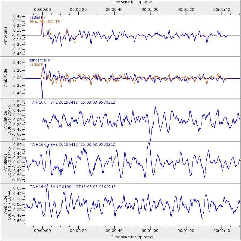
H16K Elim, AK, USA - Earthquake Result Viewer
*The percent match for this event was below the threshold and hence no stack was calculated.
| Earthquake location: |
New Britain Region, P.N.G. |
| Earthquake latitude/longitude: |
-6.4/148.7 |
| Earthquake time(UTC): |
2019/04/12 (102) 14:51:28 GMT |
| Earthquake Depth: |
10 km |
| Earthquake Magnitude: |
5.9 Mww |
| Earthquake Catalog/Contributor: |
NEIC PDE/us |
|
| Network: |
TA USArray Transportable Network (new EarthScope stations) |
| Station: |
H16K Elim, AK, USA |
| Lat/Lon: |
64.64 N/162.24 W |
| Elevation: |
216 m |
|
| Distance: |
79.6 deg |
| Az: |
19.325 deg |
| Baz: |
229.787 deg |
| Ray Param: |
$rayparam |
*The percent match for this event was below the threshold and hence was not used in the summary stack. |
|
| Radial Match: |
55.10886 % |
| Radial Bump: |
400 |
| Transverse Match: |
63.980858 % |
| Transverse Bump: |
400 |
| SOD ConfigId: |
13570011 |
| Insert Time: |
2019-05-02 22:37:52.738 +0000 |
| GWidth: |
2.5 |
| Max Bumps: |
400 |
| Tol: |
0.001 |
|
Signal To Noise
| Channel | StoN | STA | LTA |
| TA:H16K: :BHZ:20190412T15:03:03.950021Z | 1.977294 | 4.4728307E-7 | 2.2620969E-7 |
| TA:H16K: :BHN:20190412T15:03:03.950021Z | 2.0459275 | 3.7258013E-7 | 1.8210818E-7 |
| TA:H16K: :BHE:20190412T15:03:03.950021Z | 0.97850704 | 1.5958413E-7 | 1.630894E-7 |
| Arrivals |
| Ps | |
| PpPs | |
| PsPs/PpSs | |


